
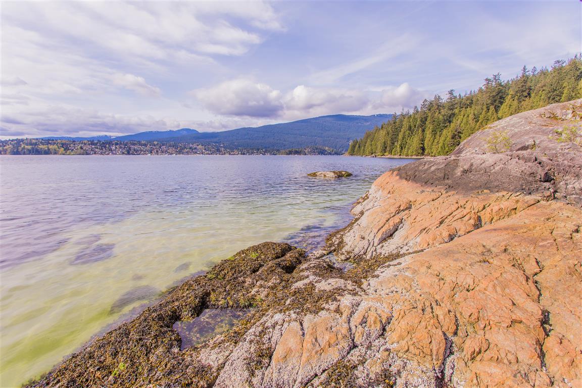
47 hikes to do around Metro Vancouver this spring


Spring has arrived, which means it is time to stretch out those legs and hit the great outdoors. Rain or shine, it’s a fine time to chase some views and conquer the trails.
To get you started, we’ve put together a bumper list of hikes of all varieties across Metro Vancouver, the North Shore, Bowen Island, the Fraser Valley, and the Sea-To-Sky.
From lush green forests to roaring waterfalls, from rocky beaches to epic sunsets, you’re sure to find some inspiration to get you outdoors. Happy hiking!
Vancouver
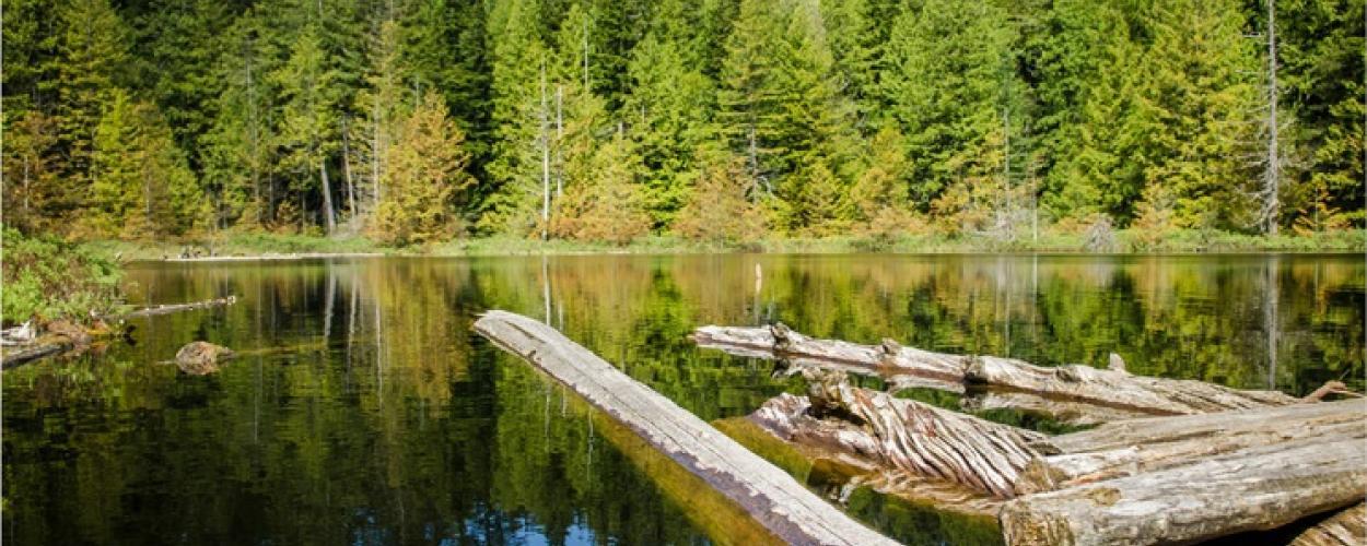
Foreshore Trail
View this post on Instagram
What: This trail through Pacific Spirit Regional Park passes through Vancouver’s famously nudist Wreck Beach. Along the way, you’ll enjoy scenic views and see an old WWII tower designed to warn Vancouver of an impending attack. Note that more than half of the trail follows the beach, which is rocky, slippery, and can be challenging during high tides.
How long: 3 hours or 5 km
Where: Starts and ends at the Acadia Beach parking lot on NW Marine Drive, just past Pacific Spirit Regional Park at UBC, Vancouver
Get there: A 20-minute drive from downtown Vancouver, or take bus 44
Stanley Park

EB Adventure Photography/Shutterstock
What: A quintessential Vancouver hike through a beautiful urban park. Stanley Park is full of many networks of trails for cycling and hiking. Venture into the forest to find Beaver Lake, but watch out for the coyotes during the denning season!
How long: 2 hours or 6.5 km
Where: Starts near the Rose Garden and loops back around in Stanley Park, Vancouver
Get there: A 10-minute drive from downtown Vancouver, or take bus 19
Pacific Spirit Regional Park
View this post on Instagram
What: Pacific Spirit Regional Park offers a huge network of easy trails in an oasis of green forest, trickling creeks and muddy bogs in Vancouver’s South Endowment Lands. Watch out for dog walkers on the trails as you flex your legs in the forest.
How long: 3 hours or 10 km
Where: Starts and ends at the park entrance on 16th Avenue next to Camosun Park, Vancouver
Get there: A 10-minute drive from downtown Vancouver, or take the SkyTrain to King Edward, then bus 33
Iona Beach Regional Park
View this post on Instagram
What: This hike follows a long, narrow beach and grass area along the mouth of the Fraser River. It offers views of the Georgia Strait and a dramatic descent into hundreds of logs washed up along the shoreline.
How long: About 1 hour or 6 km if you loop
Where: Start at the parking lot off Iona Island Causeway in Richmond
Get there: A 35-minute drive from downtown Vancouver
North Shore
Baden Powell Trail from Lynn Canyon to Grouse
View this post on Instagram
What: This route hugs the North Shore’s steep mountain slopes, taking you through scenic forests and over several creeks. It has quite a few stairs and uphill sections, and it is definitely best to prepare for the conditions. Just note that it has a different start and ending point, so be prepared ahead of time.
How long: 5 hours or 10 km
Where: It starts at a steep set of stairs between the main and overflow parking areas in Lynn Headwaters Regional Park and ends at the base of Grouse Mountain
Get there: It’s a 40-minute drive from downtown to Lynn Headwaters Regional Park, or you can take the Seabus plus bus 228 instead
Baden Powell Trail from Deep Cove to Lynn Canyon

EB Adventure Photography/Shutterstock
What: This North Vancouver hike begins with a walk up to Quarry Rock, offering sweeping views of Deep Cove and Indian Arm. It then continues into lush forests, scenic canyons, and waterfall views. It is recommended all year round, but if you don’t have the proper gear, maybe wait for a sunny day.
How long: 5 hours or 12 km
Where: Starts at the Baden Powell Trailhead on Panorama Drive in Deep Cove and ends at Lynn Canyon Suspension Bridge
Get there: A 40-minute drive from downtown, or take the Seabus plus buses 229 and then 212 instead. From Lynn Canyon, take bus 229, then the Seabus
Norvan Falls
View this post on Instagram
What: This hike will have you clambering over streams, tree roots, and rubble as you make your way through groves of old-growth cedar – but it’s all worth it when you get to the falls. Recommended all year round.
How long: 5 hours or 14 km
Where: Starts and ends at the parking lot of Lynn Headwaters Regional Park
Get there: A 40-minute drive from downtown, or take the Seabus plus bus 228 instead
Brothers Creek Loop
View this post on Instagram
What: This hike, open to the public but on private property, offers glimpses of waterfalls and takes you past the Candelabra Fir, a huge tree that towers over the surrounding forest. Not recommended before April.
How long: 4 hours or 7 km
Where: Starts and ends on Millstream Road near Henlow Road in the British Properties area
Get there: A 30-minute drive from downtown, or take buses 250 then 254 instead
Big Cedar And Kennedy Falls Trail
View this post on Instagram
What: A rugged hike into the back-country, across roots, creeks and fallen trees, past an old-growth cedar, with several trees growing on it, and ending at a spectacular waterfall. Recommended all year round.
How long: 5 hours or 10 km
Where: Starts and ends at the top of Mountain Highway
Get there: A 30-minute drive from downtown, or take bus 210 instead
Lighthouse Park
View this post on Instagram
What: There are many short, easy trails offering breathtaking ocean views, huge, old-growth Western Red Cedars, and the picturesque picnic spot of Starboat Cove.
How long: Up to 2 hours or 6 km
Where: Starts and ends at Lighthouse Park parking lot – Beacon Lane, West Vancouver
Get there: A 40-minute drive from downtown, or take bus 250 all the way there instead
Capilano Pacific Trail
View this post on Instagram
What: This easy upward trail follows the Capilano River, taking you from pavement to rocky shores and beaches, past steep cliffs, and through thick rainforest to the imposing Cleveland Dam.
How long: 2 hours or 7.5 km one way
Where: Starts at Ambleside Beach in West Vancouver, ends at the Cleveland Dam in North Vancouver
Get there: A 15-minute drive from downtown, or take bus 250 or 251 to a stop nearby instead
Lynn Loop
View this post on Instagram
What: Enjoy a forest hike among cedar and hemlock trees, with views of Vancouver Island and some of the Gulf Islands, then stroll back along the gushing waters of Lynn Creek.
How long: 1.5 hours or 5.1 km
Where: Starts and ends in Lynn Headwaters Regional Park – Lynn Valley Road, North Vancouver
Get there: A 40-minute drive from downtown, or take the Seabus then 228 bus instead
Cypress Falls
View this post on Instagram
What: This easy hike takes you along Cypress Creek through forests of moss-covered, old-growth trees and past views of two gorgeous waterfalls as they pour into the canyon below.
How long: 1.5 hours or 3 km
Where: Trail starts and ends at Cypress Falls Park – Woodgreen Place, West Vancouver
Get there: A 30-minute drive from downtown, or take bus 253 Caufield all the way there instead
Maplewood Flats
View this post on Instagram
What: The trail through Maplewood Flats Conservation Area offers picnic tables, scenic views, and rocky terrain. Managed by the Wild Bird Trust of BC, it is also a popular bird-watching park – look out for the more than 200 species of birds spotted in the area annually.
How long: 45 minutes or 2.5 km
Where: Starts and ends in the Maplewood Flats parking lot off the Dollarton Highway in North Vancouver.
Get there: A 20-minute drive from downtown Vancouver or take buses 209 then 212.
Whyte Lake
https://westvancouver.ca/
What: Whyte Lake Park is a small, peaceful lake in the hills above Horseshoe Bay, in the largest park in West Vancouver. The trail to the lake is surrounded by wetlands, creeks and old-growth forest and ends at a small lakeside dock. Watch out for snow on the boardwalks.
How long: 2 hours or 5 km
Where: Starts and ends at the metal gate in the gravel parking area just off Westport Road, off Woodgreen Drive, in West Vancouver
Get there: A 30-minute drive from downtown Vancouver
Whytecliff Park
View this post on Instagram
What: This park in West Vancouver boasts spectacular views of Howe Sound, a myriad of easy trails weaving through the forest, plus a beach, island area, and the possibility of scuba diving.
How long: 1.5 hours or 2 km
Where: Starts and ends at the top of the overflow parking lot off Marine Drive near Horseshoe Bay, West Vancouver
Get there: A 45-minute drive from downtown Vancouver
Fisherman’s Trail
View this post on Instagram
What: This lush trail descends into the forests of the Lower Seymour Conservation Reserve and ends at the Mid Valley Viewpoint. It is fairly long, offers a fantastic forest view, and is wide enough to accommodate both hikers and bikers.
How long: 5 hours or 12 km
Where: Walk to the east side of the parking lot area and look for a trail marked with a sign for Homestead Trail
Get there: A 40-minute drive from downtown Vancouver
Lower Hollyburn
View this post on Instagram
What: Although the trails near the top of Cypress are covered with snow until the summer, the lower elevations become free game earlier in the season. The trails pass by several gorgeous lakes: blue Gentian Lake, West Lake, and First Lake.
How long: 4.5 hours or 10 km
Where: The trail starts at the Cypress Mountain lookout point. Visitors can park at the lookout and walk east towards the outhouse
Get there: A 40-minute drive from downtown Vancouver
Capilano Canyon
View this post on Instagram
What: This easy trail offers beautiful views of Grouse Mountain and the Lions in the distance as you walk through hemlock and fir trees, clambering over tree roots, surrounded by rainforest. You can also stop at a salmon hatchery on the way. Note this is a free trail in Capilano River Regional Park, separate from the famed Capilano Suspension Bridge.
How long: 1 hour or 2.6 km
Where: Starts and ends at Cleveland Dam off Capilano Road, North Vancouver
Get there: A 30-minute drive from downtown, or take the Seabus across to North Vancouver then bus 236
Rice Lake
View this post on Instagram
What: This is a calm, quiet lake full of life and natural beauty on the edge of Lynn Headwaters Regional Park in North Vancouver. There are several viewpoints and trails around the lake with benches to relax and take in the area’s natural beauty.
How long: 1 hour or 3 km
Where: Starts and ends at the parking lot north of Capilano College, on Lillooet Road in North Vancouver
Get there: About 40 minutes’ drive from downtown Vancouver, or take the Seabus across to North Vancouver then bus 228
Bowen Island
Mount Gardner
View this post on Instagram
What: This hike on Bowen Island takes you through a meadow to Killarney Lake and up a steep forested trail to spectacular viewpoints overlooking the Howe Sound, the Sunshine Coast, West Vancouver, and Burrard Inlet.
How long: 7 hours or 17 km
Where: Starts and ends at the ferry terminal at Snug Cove, Bowen Island
Get there: A 45-minute drive from downtown Vancouver to Horseshoe Bay, then a 20-minute ferry to Snug Cove on Bowen Island
Killarney Lake
View this post on Instagram
What: This is a scenic hiking trail around Killarney Lake on Bowen Island. Along the way, you’ll meander through a lush hemlock forest and past a marsh of eerie-looking cedar stumps, as well as enjoy lakeside views of the wintry waters.
How long: 2 hours or 9 km
Where: Starts and ends at the ferry terminal at Snug Cove, Bowen Island
Get there: A 45-minute drive from downtown Vancouver to Horseshoe Bay, then a 20-minute ferry to Snug Cove on Bowen Island
Dorman Point

Daniel Just Photography/Shutterstock
What: A pretty, steep, but quick hike on Bowen Island, offering beautiful views looking out over Howe Sound. This can easily be combined with the hike around Killarney Lake.
How long: 1 hour or 2.5 km
Where: Starts and ends at the ferry terminal at Snug Cove, Bowen Island
Get there: A 45-minute drive from downtown Vancouver to Horseshoe Bay, then a 20-minute ferry to Snug Cove on Bowen Island
Port Moody and surrounding area
Sendero Diez Vistas–Port Moody
View this post on Instagram
What: This challenging hike around Buntzen Lake in Port Moody offers you 10 beautiful views. Take in everything from the surrounding lakes and mountains to Deep Cove, downtown Vancouver, and Indian Arm. If you don’t feel like hiking, you can always take a refreshing dip in the lakeside beaches instead.
How long: Up to 7 hours or 15 km
Where: Starts and ends at the Buntzen Lake parking lot in Port Moody
Get there: It’s a one-hour drive from downtown, or you can take the SkyTrain to Port Moody, then bus 182
Jug Island Beach–Belcarra
View this post on Instagram
What: This hike takes you through a moss-covered forest to a beach facing Jug Island, a tiny, gorgeous, and inaccessible (unless you’re willing to swim) island just off the northern tip of Belcarra Regional Park. You’ll also be able to enjoy good views of Indian Arm and numerous eagle and seal sightings.
How long: 2.5 hours or 5.5 km
Where: Starts and ends at the parking lot of Belcarra Regional Park – off Bedwell Bay Road, near Belcarra
Get there: A one-hour drive from downtown Vancouver, or take the SkyTrain to Port Moody, then bus 182
Swan Falls–Anmore
View this post on Instagram
What: Swan Falls, near Buntzen Lake in Anmore, is reached by a steep, intermediate hike around the lake. Not only will you get a gorgeous view of the waterfall from below, but you’ll also be able to reach the bluffs near the top of the falls.
How long: 3.5 hours or 10 km
Where: The trail starts and ends at the dog off-leash area in the Buntzen Lake Recreation Area parking lot, off Sunnyside Road in Anmore, north of Port Moody
Get there: A one-hour drive from downtown Vancouver, or take the SkyTrain to Port Moody, then bus 182
Admiralty Point–Belcarra
buntzenlake.ca
What: This short hike in Belcarra Regional Park offers gorgeous views of Mount Seymour, Deep Cove, and Burnaby Mountain over the waters that link Indian Arm and Burrard Inlet. The trail meanders through the forest and along the shoreline to a rocky outcrop and beach.
How long: 1.5 hours or 5 km
Where: Trail begins and ends in the parking lot of Belcarra Regional Park, off Bedwell Bay Road in Belcarra
Get there: It’s one-hour drive from Vancouver, or you can take the SkyTrain to Port Moody, then bus 182
Burnaby
Burnaby Lake Regional Park
View this post on Instagram
What: Burnaby Lake is the largest lake in Metro Vancouver and boasts a 10-kilometre hiking path that loops around the entire park. Look out for ducks, geese, and beavers as you stroll over boardwalks and bridges alongside the lake and over creeks.
How long: 2 hours or 10 km
Where: The trail starts along the edge of the sports fields beyond the Rugby Club, off Kensington Avenue in Burnaby
Get there: A 30-minute drive from downtown Vancouver, or take the SkyTrain to Sperling-Burnaby Lake Station
Burnaby Mountain
View this post on Instagram
What: With multiple trails of various difficulties, also popular with mountain bikers, there’s no shortage of hiking potential on Burnaby Mountain. Watch out for the aptly named steep Cardiac Hill, but enjoy the green forest and city views.
How long: Up to 3 hours or 7 km
Where: Starts and ends at the eastern edge of Pipeline Trail off North Road in Burnaby
Get there: Either a 35-minute drive from downtown Vancouver or take the SkyTrain to Burquitlam Station
Deer Lake
View this post on Instagram
What: This flat, easy walk around Deer Lake passes by a beach, a viewing tower, and a pier. Look out for the former site of the infamous Oakalla Prison, and stop in at the Shadbolt Centre for the Arts and Burnaby Art Museum along the way.
How long: An hour or 5 km
Where: The trail starts and ends on the east side of the lake along Sperling Avenue, Burnaby
Get there: A 30-minute drive from downtown Vancouver, or take the SkyTrain to Metrotown and get bus 144
Velodrome Trail
View this post on Instagram
What: This steep trail, sometimes referred to as Burnaby’s [Grouse] Grind, requires hikers to climb more than 500 wooden stairs. As a result, it gets an “intermediate” rating.
How long: An hour or 3 km
Where: Starts at the northeast corner of the Velodrome near Barnet Road and finishes at the Japanese totem poles near Horizon Restaurant in Burnaby
Get there: A 30-minute drive from downtown Vancouver, or take bus 160 direct to the Velodrome
Coquitlam
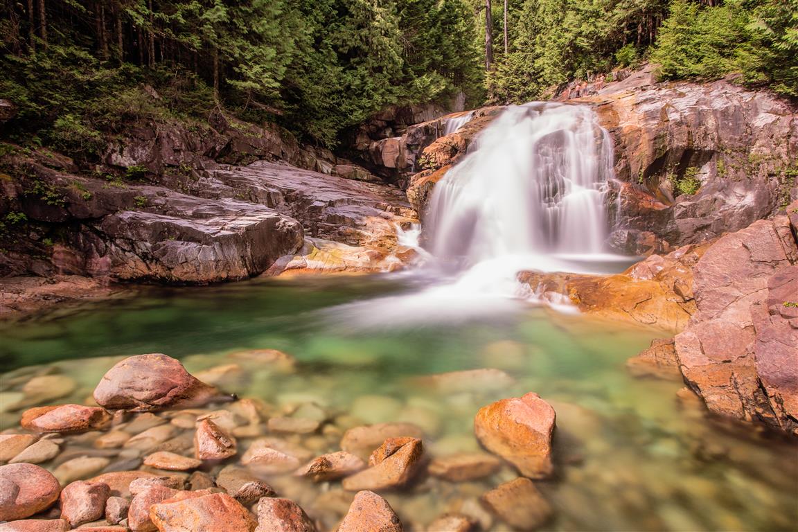
Crystal Falls
View this post on Instagram
What: The Scenic Crystal Falls in Coquitlam is easily accessible on a short trail running along the Upper Coquitlam River. Wander through a moss-covered forest, hop over tiny streams, play along the path, and pack a picnic for when you reach the falls.
How long: 2 hours or 7 km
Where: The trail starts and ends at an unmarked trailhead on Karley Crescent, where it meets Shaughnessy Street in Coquitlam
Get there: A 45-minute drive from downtown Vancouver, or take the SkyTrain to Lafarge-Lake Douglas, then bus 188
Sawblade Falls
View this post on Instagram
What: The Woodland Walk Trail takes you to Sawblade Falls in the mountains above Coquitlam. Through forest and over creeks, the trail first takes you to Woodland Falls and then, after several switchbacks, to the much more spectacular Sawblade Falls.
How long: 3 hours or 8 km
Where: Trail starts and ends to the left of the metal gate at the end of Harper Road, just before the PoCo & District Hunting & Fishing Club, in Coquitlam
Get there: A 45-minute drive from downtown Vancouver
Maple Ridge
Kanaka Creek Cliff Falls
View this post on Instagram
What: The Cliff Falls area of Kanaka Creek in Maple Ridge is a great spot for an easy hike through the forest, past calm creeks and rushing rapids. Enjoy a picnic with a view of the waterfall then finish up with a visit to the local salmon hatchery.
How long: 2 hours or 4 km
Where: Trail starts and ends at Cliff Park – 251 Street, Maple Ridge.
Get there: A one-hour drive from downtown Vancouver, or take the SkyTrain to Braid Station, then buses 791 and C48
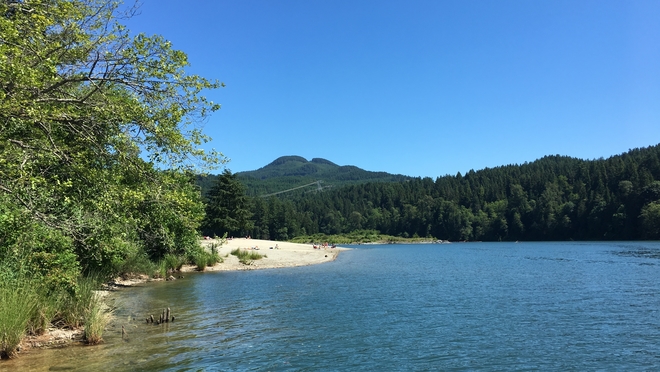
Mike Lake
View this post on Instagram
What: This short, scenic trail in Golden Ears Provincial Park is a meander over tree roots, through calm forests, and past lake views. Don’t forget to head out onto the dock for a full view of Mike Lake before you leave.
How long: 45 minutes or 2 km
Where: About 4.5 km from the gates of Golden Ears Provincial Park on Fern Avenue in Maple Ridge
Get there: One hour and 30-minute drive from downtown Vancouver
Gold Creek Falls
What: To get to this lake in Maple Ridge, the trail you’ll follow meanders over moss, past mountain vistas, and through rainforest to reach fantastic views of the falls from above and below.
How long: 2 hours or 5.5 km
Where: Trail starts and ends at the last parking lot on Golden Ears Parkway near Alouette Lake in Maple Ridge
Get there: One hour and 30 minutes drive from downtown Vancouver
Pitt Meadows
Widgeon Falls
View this post on Instagram
What: A trip to Widgeon Falls, north of Pitt Meadows, allows you to combine a canoe ride, a scenic hike, and some wading all in one day. Keep an eye out for herons, deer, and bears as you make your way from the shoreline to the waterfall through the thick forest.
How long: 5 hours or 6 km
Where: Paddle starts and ends at Pitt Lake, at the end of Neaves Road, north of Pitt Meadows. If you need a canoe, try Pitt Lake Canoe Adventure Rentals on 778-984-5334 or 604-460-8837.
Get there: One hour and 15 minutes’ drive from downtown Vancouver
Surrey
Aldergrove Regional Park
View this post on Instagram
What: This park on the boundary between Aldergrove and Langley is popular with horseback riders. The trails within take you through the forest, along waterways, atop wooden bridges and over creeks. The view from the area’s rolling hills is worth checking out.
How long: 2 hours or 5 km
Where: Trail starts and ends at the east end of the parking lot off 8th Avenue in Aldergrove
Get there: A one-hour 30-minute drive from downtown Vancouver
- You might also like:
- 10 of BC's best bike paths for a stress-free ride with 10/10 views
- Pay parking at Granville Island sees rate hikes and significantly expanded hours
- This BC city is getting serious recognition and we can see why
Campbell Valley Regional Park
View this post on Instagram
What: This park has a sprawling network of trails covering 29 km, through forest and open fields, and over wooden boardwalks and marshes. Look out for the Equestrian Centre and the historic Langley Speedway, where you can still see the damage from past crashes.
How long: 1.5 hours or 4 km for a short hike — or pick a longer one!
Where: Trail starts and ends at the south end of the parking lot off 16th Avenue in Surrey
Get there: An hour’s drive from downtown Vancouver
Tynehead Regional Park
View this post on Instagram
What: This popular park has plenty of trails, offering dog off-leash areas, a hatchery, a picnic area, and views of the park and the Serpentine River — all while enjoying a stroll through the forest and crossing several streams.
How long: 1.5 hours or 4.5 km
Where: Trail starts and ends at the parking lot for the Tynehead Hatchery off 96th Avenue in Surrey
Get there: A 45-minute drive from downtown Vancouver, or take the SkyTrain to Surrey Central Station, then bus 337
Langley
Derby Reach Regional Park
View this post on Instagram
What: An easy-to-walk trail with minimal elevation features a camping area, an off-leash area for dogs, and trails that hug the Fraser River.
How long: 2.5 hours or 8 km
Where: Trail starts from either the Edgewater Bar area or the historic Fort Langley area
Get there: A one-hour drive from downtown Vancouver
Serpentine Fen Nature Trail
View this post on Instagram
What: The scenic walk through a nature reserve is a popular spot for bird watchers. Over 100 different species frequent the area based on the time of year.
How long: 1.5 hours or 3.5 km
Where: The trail starts from the gravel parking area of King George Blvd, just north of 44th Avenue
Get there: A 45-minute drive from downtown Vancouver
Fraser Valley
Hayward Lake–Mission
bchydro.com
What: There are two trails around Hayward Lake–Railway Trail or Reservoir Trail and there’s lush forest, a beautiful lake, and even a waterfall to enjoy. There are some closures, so head to the website before you go so you aren’t caught unaware.
How long: The Railway Trail is 3.5 hours or 12km, and the Reservoir Trail is 5.5 hours or 17 km.
Where: Both trails start and end at Hayward Lake Recreation Area parking lot, off Dewdney Trunk Road in Mission
Get there: A one-hour 20-minute drive from downtown Vancouver
Teapot Hill – Cultus Lake
View this post on Instagram
What: A short hike uphill reveals a stunning view of Cultus Lake. The hike is filled with a mix of deciduous and coniferous trees and a beautiful mix of wildflowers. The trail itself is also packed with teapots hidden along the path.
How long: 2 hours or 5 km
Where: Park in the Teapot Hill parking lot and start the hike heading uphill, there will be an outhouse and park map on the left
Get there: A one-hour 40-minute drive from downtown Vancouver
Mount Thom–Chilliwack
View this post on Instagram
What: This steep hike up Mount Thom in Chilliwack offers a scenic view of Cultus Lake and the Fraser Valley. Expect a climb steadily upwards on both switchbacks and long stretches of trail wrapping around the mountain.
How long: 2.5 hours or 10 km
Where: Starts and ends at Sylvan Drive – Promontory neighbourhood, Chilliwack
Get there: A one-hour 30-minute drive from downtown Vancouver
Sumas Mountain–Abbotsford
View this post on Instagram
What: The difficult hike up Sumas Mountain takes you through lush forests, over a river running through a ravine, and up, up, up onto an often overgrown, sometimes narrow trail. Along the way, take in the beautiful Chadsey Lake and Fraser Valley vistas before hitting the top for views of Mount Baker on a clear day. It is not recommended before May.
How long: 6.5 hours or 13.5 km
Where: The trailhead is marked with orange markers about 9 km down Sumas Mountain Road after the turnoff from North Parallel Road in Abbotsford
Get there: A one-hour 30-minute drive from downtown Vancouver
Seven Sisters Trail–Cultus Lake

Didi Marie/Shutterstock
What: A short hike in the Cultus Lake area brings hikers to a grove of old-growth Douglas Fir trees. While there were once seven humongous trees, only three remain — although their sheer size is more than impressive.
How long: 1 hour or 3 km
Where: The trail begins from either the Entrance Bay Campground or the Clear Creek Campground. Parking is limited
Get there: A one-hour 40-minute drive from downtown Vancouver
Information on how to prepare for your trip and stay safe whilst out hiking is available from North Shore Rescue and AdventureSmart.