
Snow way! Big temperature drop and flurries are in the forecast for Metro Vancouver


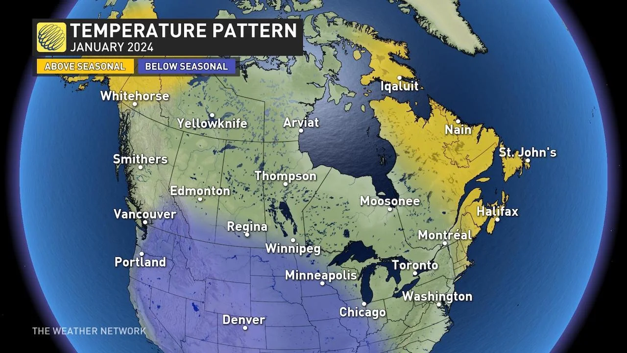
The cold and snow is coming for Metro Vancouver after an unusually warm start to winter, according to a new January forecast.
The Weather Network predicts that an arctic front will be blowing in next week, bringing chilly temperatures and a chance of flurries.
“While El Niño is still just as strong, a major change in the jet stream pattern is already underway,” The Weather Network said.
The Weather Network
“As we head into the second week of January, this Arctic air will plunge south across Western and Central Canada, as well as the United States.”
But, it’s not expected to be far from average temperatures for this time of year for Vancouver residents.
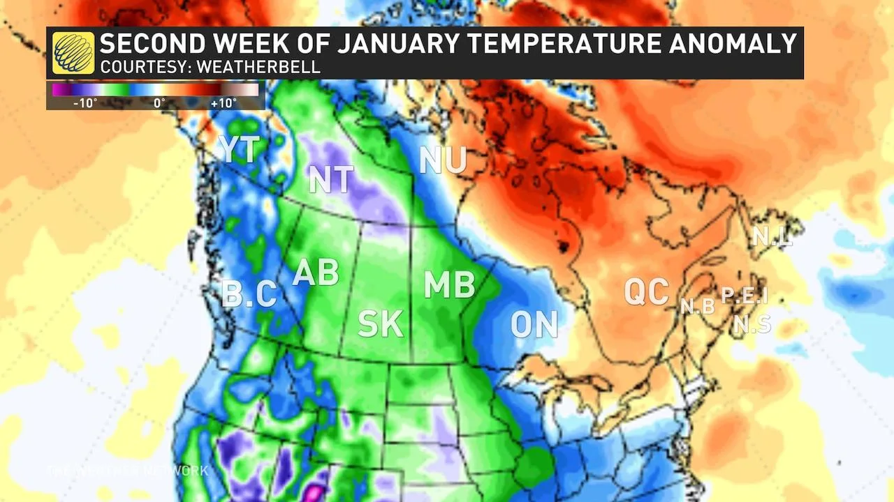
Temperatures in BC could be well below zero for the second week of January. (The Weather Network)
Looking at the seven-day forecast, there is a chance of wet snow in Vancouver as early as this weekend. However, it doesn’t appear that those flakes will stick around for long, much to the dismay of many who have been hoping for a snow day.

A look at the forecast as of Wednesday. (The Weather Network)
For the local ski hills, there is a chance that the low snowpack will build up over the next few days, and the forecast shows that it could come as early as Friday.
Cypress Mountain, among those hills with minimal runs open due to the warm weather and rain, posted some hope for skiers and snowboarders in its daily snow update today.
“[T]he first signs of a weather pattern shift may show up today, as Snow-forecast is calling for a chance of light snow (or mixed) throughout the day. Just a taste of what might come later in the week,” the mountain’s website reads in part.
BC is experiencing some of the warmest temperatures in December, with even the Central Interior residents seeing weather more like spring than winter.
Typically, January is the province’s coldest month, and many expect a significant drop will be on the way.
However, will it come close to breaking historic cold-temperature records? We asked the experts at Environment and Climate Change Canada to break down the coldest day on record, and for Vancouver, that number would have to be colder than -17.8°C, the likes of which we haven’t felt since 1968.