City of Vancouver seeking public input on the future of 80 acres in False Creek South

Half a century after the completion of the False Creek South neighbourhood, the City of Vancouver is looking to revisit the area for its potential to help provide additional affordable homes and further foster the Metro Core economy.
The municipal government announced today it is launching public consultation on 80 acres of city-owned lands in False Creek South — the area between the Burrard Street Bridge and Cambie Street Bridge, but excluding Squamish First Nation’s Senakw on reserve and the federally owned Granville Island area.
- See also:
This planning exercise is being conducted now as the 60-year leases in False Creek South are set to expire over the next 15 years to 25 years — between 2036 and 2046.
Currently, the city-owned lands contain approximately 1,800 homes built in the 1970s and early 1980s. An additional 1,354 homes are on land that is owned by the private sector or other levels of government.
The leased land includes six co-ops totalling 573 homes, four market rental buildings totalling 124 homes, six non-profit rental buildings totalling 455 homes, and 13 stratas totalling 669 homes.

False Creek South map. (City of Vancouver)

The City of Vancouver owns 80% of the False Creek South neighbourhood. (City of Vancouver)
Statistics show the overall area, including properties not owned by the city, is home to about 5,600 residents, with 17% of the population identifying as a visible minority compared to 52% citywide. Residents also have an older median age and a higher median household income than the rest of the city.
The process is also intended to provide residential and business leaseholders with more clarity with their expiring leases on city-owned land.
“The purpose of this engagement is to explore the future of these lands, for the next 50 years and beyond, while striving to balance the interests of current neighbourhood residents with those of all Vancouver residents who own this land,” reads a city backgrounder.
“This work is being undertaken from the City’s landowner perspective, and is connected but independent from the City’s False Creek South neighbourhood planning program, which is on hold.”

The reconstructed False Creek South seawall with separated and widened bike and pedestrian paths. (Kenneth Chan/Daily Hive)

Aerial of False Creek South near the old Cambie Street Bridge in the 1970s. (City of Vancouver)
The municipal government adds that it intends to maintain housing that is affordable for a wide range of people, including options for current residents. It will also respect the “original vision for False Creek South as an affordable, diverse neighbourhood,” with any redevelopment potentially phased in over the long term.
An online survey for the public consultation will remain open until February 28, 2021, and this will lead to an engagement summary report this spring.
A large city-owned parcel next to SkyTrain’s Olympic Village Station, currently used as a surface parking lot and a temporary modular housing building for the homeless, is likely a major potential development site for the municipal government.
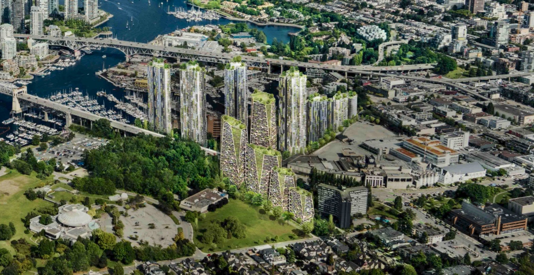
The westernmost edge of False Creek South will see significant change as a result of the Senakw redevelopment at the southern foot of the Burrard Street Bridge. In late 2019, Squamish First Nation self-approved about 6,000 rental homes in multiple towers on a reserve footprint that is 12 acres — about 7% of all of False Creek South, but with roughly twice the population in the future.

Artistic rendering of Senakw on the Squamish First Nation’s reserve at the north end of the Burrard Street Bridge. (Revery Architecture/Westbank/Squamish Nation)

