
The fall forecast for BC is out, and we are in for some stormy weather


If you’ve been enjoying the unseasonably warm autumn so far, you’re in luck. A new report is suggesting temperatures will remain comfortable through Halloween and into November in BC.
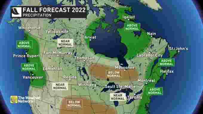
The Weather Network meteorologist Doug Gillham says while it will be warm, the storms will start rolling in soon thanks to a jet stream over Western Canada.
“Every fall pattern is at risk to be disrupted by the impact that tropical systems have on the jet stream. More specifically, the track of typhoons in the western Pacific Ocean can reinforce or temporarily disrupt the jet stream pattern across the Northern Hemisphere,” he says in his long-range forecast.
Some rain is on the way but it isn’t expected to be historic.
“We still think that BC will be impacted by moisture-laden systems in late October and November, with a risk for excessive rainfall at times, but at this point it is unlikely that we will see enough rain to verify the forecast,” he suggests.
- You might also like:
- First "wind event" of the season set to whip Metro Vancouver
- "Horrific and sad to witness": Thousands of BC salmon dead due to ongoing drought (VIDEO)
- 15 pumpkin patches in Metro Vancouver you can visit this fall
While the dry weather has allowed for late-season patio beers, it is also being blamed on an ongoing drought and late-season wildfires.
Recently, thousands of salmon were found dead in a creek in BC, unable to spawn upstream as a result of disturbingly low water levels.
This is Neekas, Heiltsuk Territory. All of these salmon went into the creek, the creek dried up b/c of no rain so far this fall, and just died, and this is just one reach! Global warming is killing everything. This is such a sad scene. Video credit, Sarah Mund pic.twitter.com/vYhEKwD5mN
— William Housty (@WilliamHousty) October 4, 2022
The South Coast saw its first major wind storm of the season over the weekend, with wind speeds above 60 km/hour. Luckily, few people lost power and the damage was minimal.
Wavy and windy beachside sunset in Vancouver’s westside tonight. #BCStorm pic.twitter.com/CVSz3kkaHz
— Claire Fenton (@Ceeceefenton) October 11, 2022
When it comes to cold, our neighbours to the east are having a tougher time with some frigid temperatures arriving in parts of Ontario and Quebec in recent days.
It’s unusual because that blast was expected to hit BC but didn’t.
The Weather Network
“Typically during late fall and winter in a La Niña year, the focus of the coldest weather is across Western Canada. However, when the coolest ocean water temperatures (compared to normal) are located in the eastern Pacific — just west of South America — rather than in the central Pacific Ocean, there is a tendency for the coldest weather to be focused farther eastward, often reaching Ontario and Quebec,” Gillham explains.