Stanley Park reopens to all cars, with cyclists now sharing the road (PHOTOS)

Nearly 10 km of orange traffic cones now line Stanley Park Drive, reestablishing road space for vehicles to reenter Stanley Park.
The Vancouver Park Board says all cars will officially be allowed into Stanley Park starting at 1 pm today, Monday, June 22, effectively ending a ban on cars into the park’s local roads since April 8.
- See also:
Park Board crews have been implementing a new temporary road system for the 1,000-acre park since Friday, following a final decision by Park Board commissioners on Thursday night to proceed with the plan.

Stanley Park Drive separated for vehicles and cyclists. (Kenneth Chan/Daily Hive)
This is deemed as a pandemic response measure that provides pedestrians on the seawall with the greater capability to practice physical distancing. Under the new configuration, all cyclists remain banned from accessing the seawall.
With the decision made to reopen the park to cars, Prospect Point restaurant and cafe reopened for business on Friday, and both The Teahouse and the Vancouver Aquarium are slated to reopen later this week.
At a cost of $200,000, the traffic cones separate the two-lane Stanley Park Drive, with the left lane used for motor vehicles and the right lane used for cyclists. Large digital signage boards along the looping roadway provide road users with directional information. The speed limit for all road users is 30 km/h.

Temporary road configuration for Stanley Park Drive: left lane for vehicles, right lane for cyclists. (Vancouver Park Board)
Roadways that are unchanged and remain accessible to vehicles include Pipeline Road, which is a two-lane, bi-directional route for vehicles, as well as Avison Way serving the aquarium.
However, the road connections between the Stanley Park Causeway and Stanley Park Drive at the northern end of the park near the Lions Gate Bridge are closed to vehicles — used for cyclists only. Normally, this is a backup route for emergency vehicles reaching an accident on the arterial roadway, and an alternate route for trapped vehicles on the Stanley Park Causeway during an accident or a closure of the bridge.

New temporary road system for Stanley Park beginning June 22, 2020. (Vancouver Park Board)
From the Vancouver Rowing Club to Information Booth
To accommodate both vehicles and cyclists, approximately 30% of the parking stalls across the entire park have been removed, including Stanley Park Drive’s curbside spaces from the Vancouver Rowing Club to Information Booth.
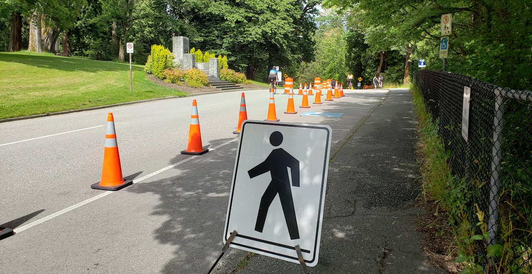
Stanley Park Drive near the Vancouver Rowing Club. (Kenneth Chan/Daily Hive)

Stanley Park Drive southwest of the Information Booth. (Kenneth Chan/Daily Hive)
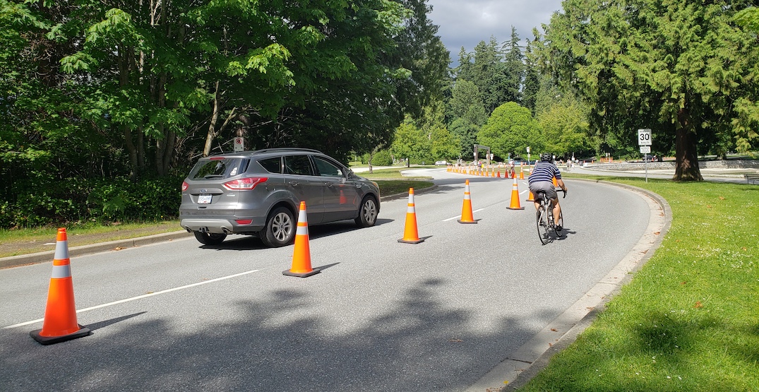
Stanley Park Drive southwest of the Totem Poles. (Kenneth Chan/Daily Hive)
From Brockton Point to Pipeline Road
The easternmost tip of the park — Hallelujah Point, Nine O’Clock Gun, Brockton Point Lighthouse — is inaccessible to cars. Due to the narrow width of Stanley Park Drive in this area, all vehicles will be directed to turn into the feeder road immediately east of the Totem Poles.
From the general area north of Lumberman’s Arch to the intersection with Pipeline Road, all of the parking stalls along the west side of Stanley Park Drive are unusable for vehicles as they are being used for the bike lane route.

Stanley Park Drive, southeast of the Totem Poles. (Kenneth Chan/Daily Hive)

Stanley Park Drive, northeast of the Totem Poles. (Kenneth Chan/Daily Hive)

Parking stalls along Stanley Park Drive, south of the intersection of Pipeline Road, used as a bike lane. (Kenneth Chan/Daily Hive)
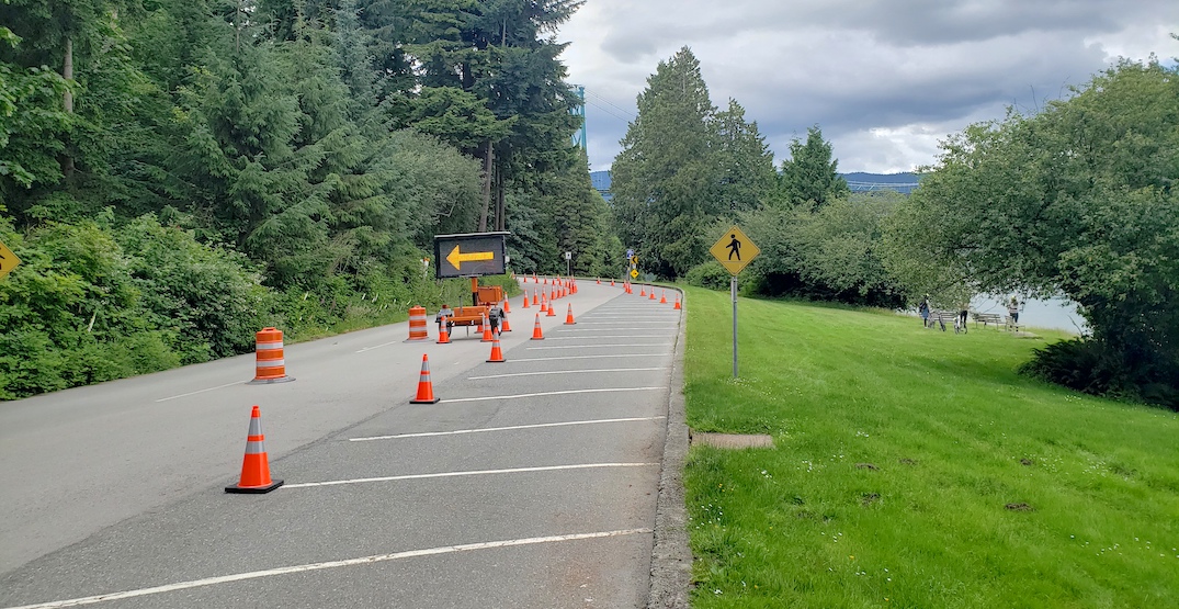
Parking stalls along Stanley Park Drive, south of the intersection of Pipeline Road, used as a bike lane. (Kenneth Chan/Daily Hive)

Stanley Park Drive at the intersection with Pipeline Road. (Kenneth Chan/Daily Hive)

Stanley Park Drive’s steep slope north of Pipeline Road. Most cyclists were observed walking their bike up this hill. (Kenneth Chan/Daily Hive)
Prospect Point
Only a handful of curbside parking stalls are available at Prospect Point to support the restaurant and cafe. The bike lane weaves in and out of the parking lot at Prospect Point, and the curbside stalls further down the road — west of the parking lot — are used for the bike lane. For this reason, Prospect Point’s parking lot is closed to public parking.

Stanley Park Drive at Prospect Point. (Kenneth Chan/Daily Hive)

Stanley Park Drive at Prospect Point. (Kenneth Chan/Daily Hive)
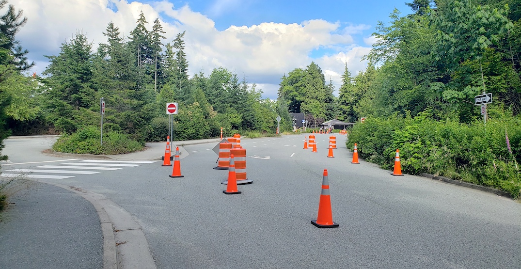
Stanley Park Drive at Prospect Point. (Kenneth Chan/Daily Hive)
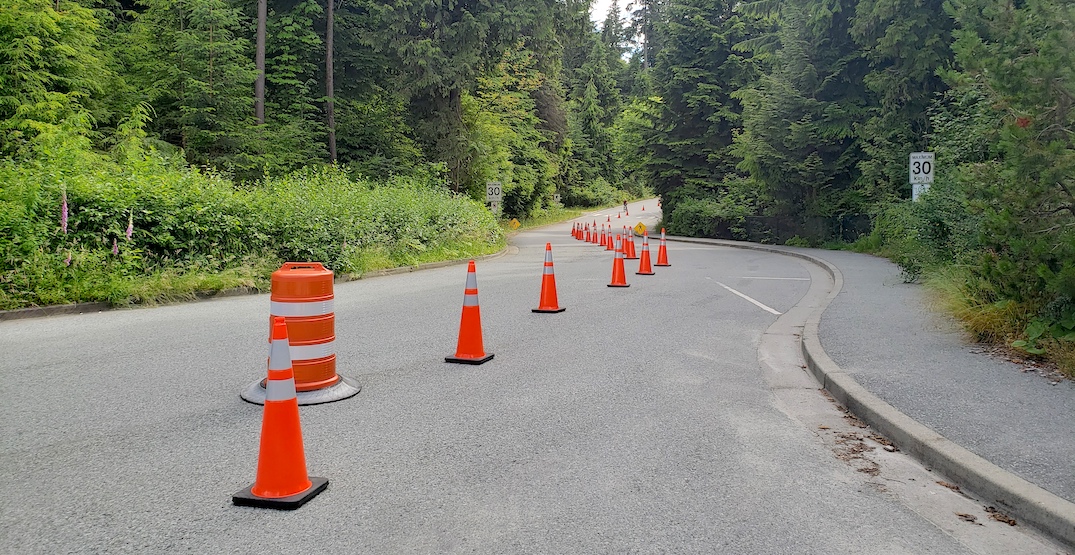
Stanley Park Drive west of Prospect Point. (Kenneth Chan/Daily Hive)
The Teahouse
At Stanley Park Drive’s diversion serving The Teahouse, the main roadway east of the restaurant building is dedicated to vehicles, while the parking lot entrance is split into two lanes, with the vehicle lane on the left and the bike lane on the right.
Some curbside stalls immediately adjacent to The Teahouse remain for the use of parking vehicles, but all of the stalls on the west side of the parking lot — the majority of the parking in this lot — are occupied by the bike lane.
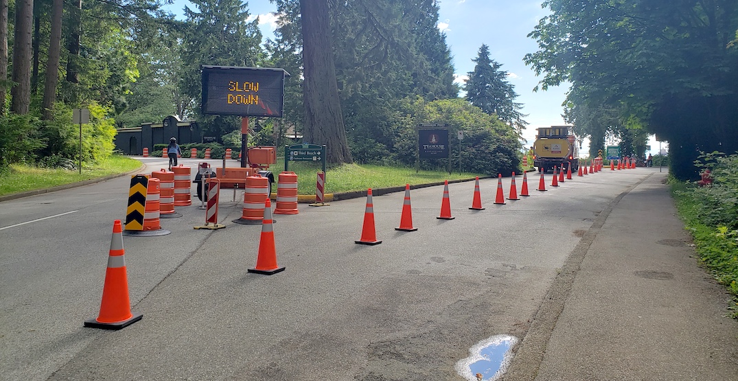
Bike lane through the parking lot of The Teahouse. (Kenneth Chan/Daily Hive)

Bike lane through the parking lot of The Teahouse. (Kenneth Chan/Daily Hive)

Bike lane through the parking lot of The Teahouse. (Kenneth Chan/Daily Hive)
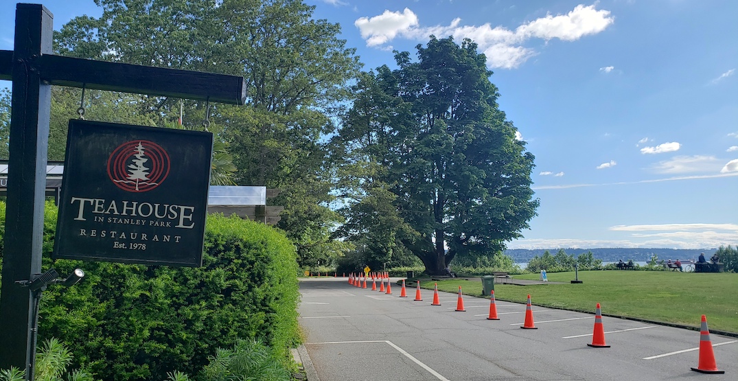
Bike lane through the parking lot of The Teahouse. (Kenneth Chan/Daily Hive)

Bike lane through the parking lot of The Teahouse. (Kenneth Chan/Daily Hive)
Second Beach Swimming Pool
Over at the area of Second Beach, the bike lane turns right into the large parking lot immediately north of the Second Beach Swimming Pool, with Stanley Park Drive and the curbside parking stalls in this area dedicated to vehicles.
However, on Sunday, when the use of the already-established road configuration was observed, virtually all cyclists ignored the directional signage and traffic cones, and maneuvered into Stanley Park Drive instead of turning into the large parking lot, which is completely inaccessible to vehicles for its purpose as a bike lane.

Stanley Park Drive entrance into the Second Beach Swimming Pool parking lot. The left lane is for vehicles, and the right lane into the parking lot is for cyclists. (Kenneth Chan/Daily Hive)
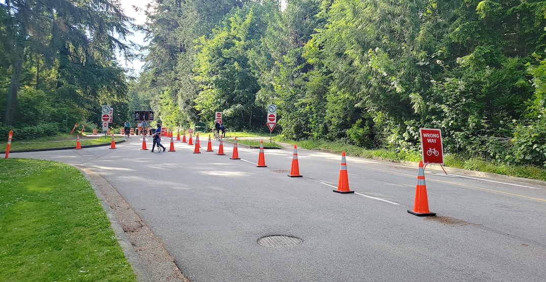
Stanley Park Drive looking north towards the exit from the Second Beach Swimming Pool parking lot. (Kenneth Chan/Daily Hive)
Between North Lagoon and Lagoon Drive
Further south, the bi-directional segment of Stanley Park Drive between North Lagoon Drive and Lagoon Drive is now separated for vehicles on the northbound lane and cyclists on the southbound lane.
North Lagoon Drive has opened up to vehicles as well, but there are no barriers, with this roadway now shared between both vehicles and cyclists.
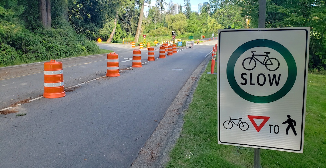
Stanley Park Drive looking south from the intersection with North Lagoon Drive. (Kenneth Chan/Daily Hive)
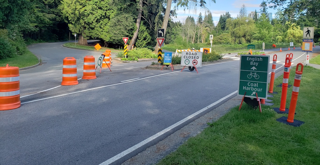
Stanley Park Drive looking south from the intersection with North Lagoon Drive. (Kenneth Chan/Daily Hive)
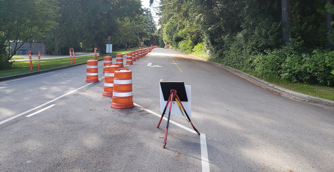
Stanley Park Drive looking north from the intersection with North Lagoon Drive. (Kenneth Chan/Daily Hive)
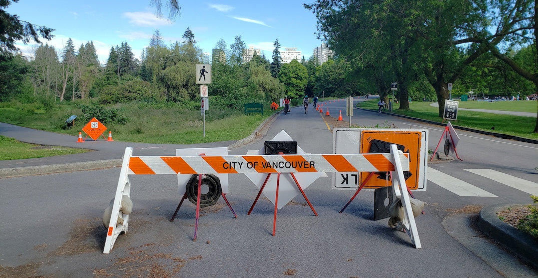
Stanley Park Drive looking south from the intersection with North Lagoon Drive. (Kenneth Chan/Daily Hive)
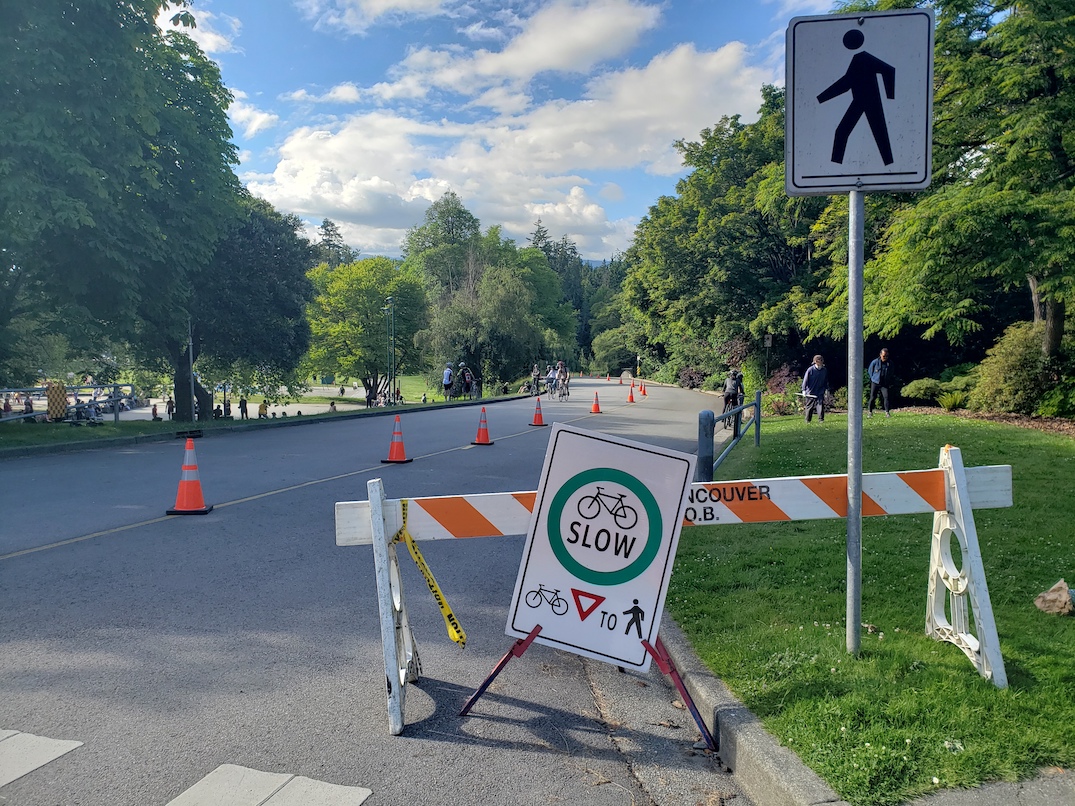
Stanley Park Drive looking north near Lagoon Drive. (Kenneth Chan/Daily Hive)
Earlier this month, Park Board commissioners approved a motion that requested staff to perform a feasibility study that identifies possible options to permanently reduce vehicle traffic in the park.

