New replacement bridge eyed between Richmond and YVR Airport

The aging swing bridge between Vancouver International Airport (YVR) and North Richmond is being eyed for a replacement project.
The provincial government recently sought the federal government, YVR, and City of Richmond’s support in launching an in-depth study on replacing the Moray Bridge, which forms the Sea Island Way eastbound arterial road crossing over the Fraser River’s middle arm.
- You might also like:
- YVR Airport planning highway-like interchange for Templeton Street intersection into McArthurGlen Mall
- 14 features of the new terminal expansion of Vancouver International Airport (PHOTOS)
- 300,000 sq ft Airport Commerce Centre to be built next to YVR Airport Station
- YVR Airport aiming to be an industrial and multi-modal transportation hub
- Vancouver International Airport considering developing lands next to runway for revenue
Such a study would not only look at the feasibility of building a new replacement crossing, but also analyze road reconfiguration and traffic management measures. This study will also look at improving road access between Sea Island (YVR) and Highway 99 along both Sea Island Way and Bridgeport Road.
Consideration will also be given to continued transportation demand growth from Richmond City Centre’s immense densification, and the long-term passenger and goods traffic growth at YVR.

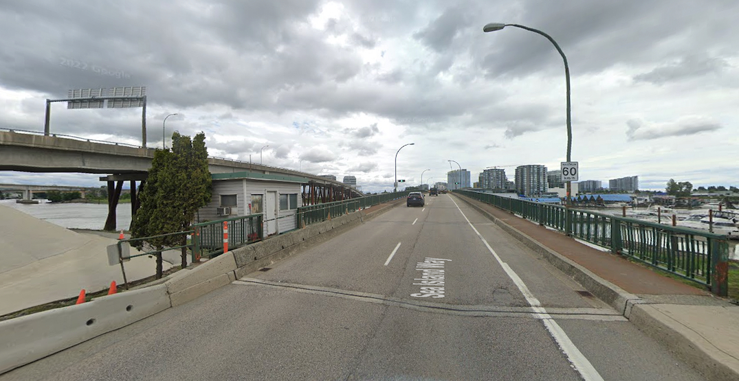
The existing Moray Bridge looking west towards Vancouver International Airport. (Google Maps)

The existing Moray Bridge looking east towards Richmond. (Google Maps)
The 1957-built swing bridge is owned and operated by the provincial government, and according to the City has now “reached the end of its useful life.”
Traffic congestion and delays occur on the two-lane, eastbound-only swing bridge whenever the crossing opens for marine traffic. Moreover, the bridge’s swing mechanism is increasingly prone to malfunctioning, which “undermines travel time reliability with adverse impacts to multi-modal traffic flow and goods movement.”
In particular, when the swing bridge fails to close, severe traffic backups occur on Sea Island Way on Sea Island, and can greatly affect the timely traffic flow on Arthur Laing Bridge and the accessibility of YVR.
As well, this swing bridge’s low height is problematic for not only the growth of marine traffic, but also future plans by the municipal government to raise dikes to address future sea level rise.
The provincial government is looking to have the federal government cover 50% of the cost of the study, which is expected to be completed by the end of 2023. The federal funding would come from the National Trade Corridors Fund.
Heads up #RichmondBC, expect traffic delays on the Moray Bridge. Follow @RichmondRCMP for updates, and @TransLink for transit updates. https://t.co/SAwJw2Ij7r
— City of Richmond BC (@Richmond_BC) June 24, 2022

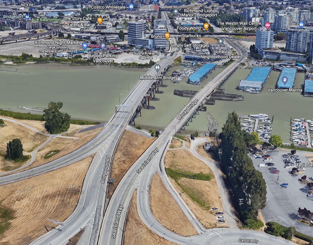
The existing Moray Bridge (bottom) and Sea Island Connector bridge (top). (Google Maps)

The existing Moray Bridge (right) and Sea Island Connector bridge (left). (Google Maps)
Major capacity and traffic flow upgrades were performed to the area two decades ago, when the three-lane, westbound-only fixed Sea Island Connector bridge — immediately to the north of the Moray Bridge — was built. The Sea Island Connector created new interchanges on Sea Island, extended Bridgeport Road westward, and turned the Moray Bridge into the one-way, eastbound-only crossing configuration that exists today.
Before the opening of the Sea Island Connector in 2001, the Moray Bridge was a bidirectional crossing, with one lane eastbound and one lane southbound.
The provincial-led study aligns with YVR’s long-term master plan’s component of an eventual replacement of the Moray Bridge.
The airport owns Arthur Laing Bridge and Dinsmore Bridge. Based on YVR’s master plan, there is a need to replace or seismically upgrade the Dinsmore Bridge, which is the crossing between Russ Baker Way on southeastern Sea Island and Gilbert Road near Richmond Oval.
There are also plans to build a highway-like interchange to replace the existing traffic signal-controlled, grade-level intersection of Grant McConachie Way and Templeton Street. A grade-separated interchange with a Templeton Street overpass would reduce congestion, and help accommodate growing traffic reaching the airport terminal, McArthurGlen Vancouver Airport Outlet Centre, and future industrial businesses along the northern edge of the North Runway.
YVR previously forecasted traffic on airport-owned bridges will increase by 17% between 2011 and 2037. Over the same period, non-airport commuter traffic is expected to account for 59% of the traffic on the bridges.
- You might also like:
- YVR Airport planning highway-like interchange for Templeton Street intersection into McArthurGlen Mall
- 14 features of the new terminal expansion of Vancouver International Airport (PHOTOS)
- 300,000 sq ft Airport Commerce Centre to be built next to YVR Airport Station
- YVR Airport aiming to be an industrial and multi-modal transportation hub
- Vancouver International Airport considering developing lands next to runway for revenue

