
26 photos showing the Vancouver skyline evolving from 1919 to 2015


In almost 100 years, Vancouver has changed dramatically, and our skyline shows it. What was once a sleepy port and rail hub, has grown to be a diverse, international city with more accolades than one can count.
Aerial photographs are especially telling of the city’s growth since the beginning of the 20th century: skyscrapers have popped up, villages have been transformed into city squares and facades have been modernized and expanded. Industries have also evolved – or evaporated – to make room for expansive planning projects and redevelopments.
Check out these mesmerizing images of how far Vancouver has come:
1919: Looking east along Georgia Street
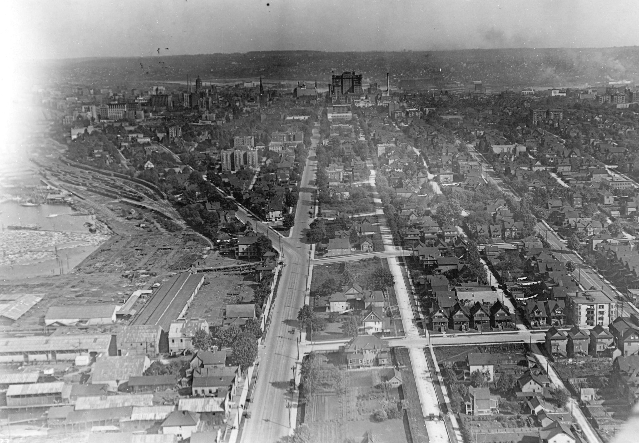
Image: City of Vancouver Archives
1919: The North Vancouver waterfront at the bottom of Lonsdale
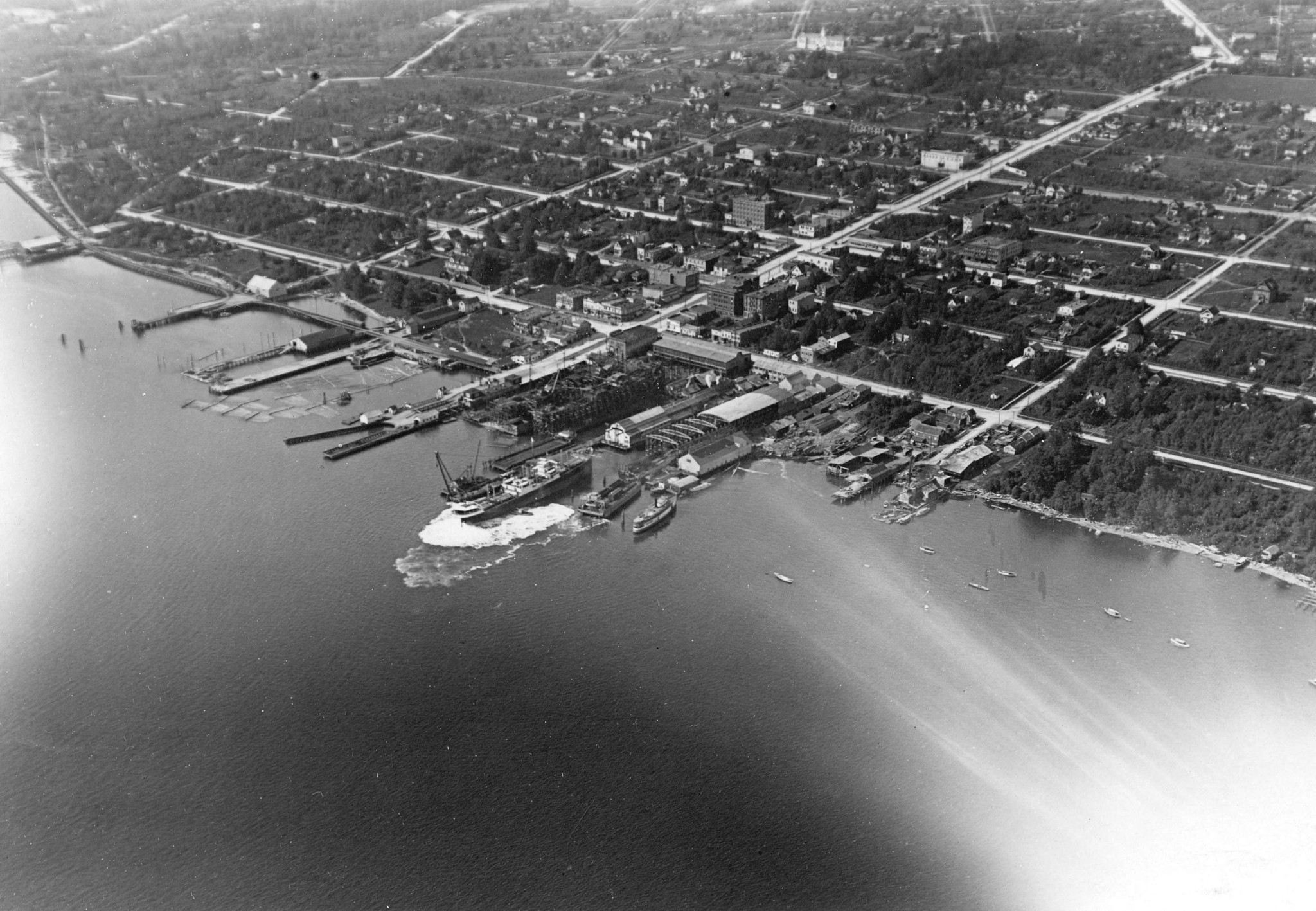
Image: City of Vancouver Archives
1926: Looking east over Stanley Park and Coal Harbour. Lions Gate Bridge has yet to be built

Image: City of Vancouver Archives
1930s: Looking east past English Bay, with the English Bay Pier in the centre and towering Hotel Vancouver in the background

Image: City of Vancouver Archives
1931: Looking east from Main Street and Pender

Image: City of Vancouver Archives
1931: Looking down Georgia Street toward the Hotel Vancouver, East Van in the background

Image: City of Vancouver Archives
1931: High above Vancouver looking toward the undeveloped North Shore mountains
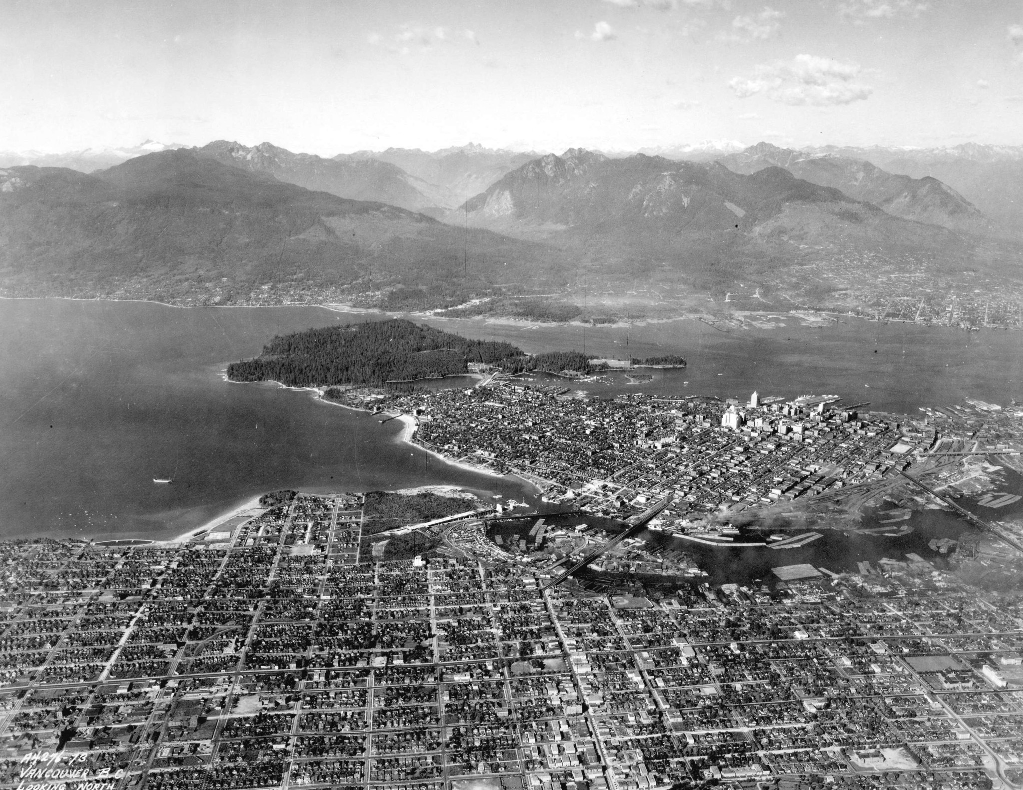
Image: City of Vancouver Archives
1935: Above Lost Lagoon looking over the Coal Harbour docks

Image: City of Vancouver Archives
1937: Vancouver’s Westside and Spanish Banks with Downtown far in the background

Image: City of Vancouver Archives
1940: The original Stanley Park Causeway next to Lost Lagoon. No condos here

Image: City of Vancouver Archives
1940-1948: Above Downtown on a winter’s day
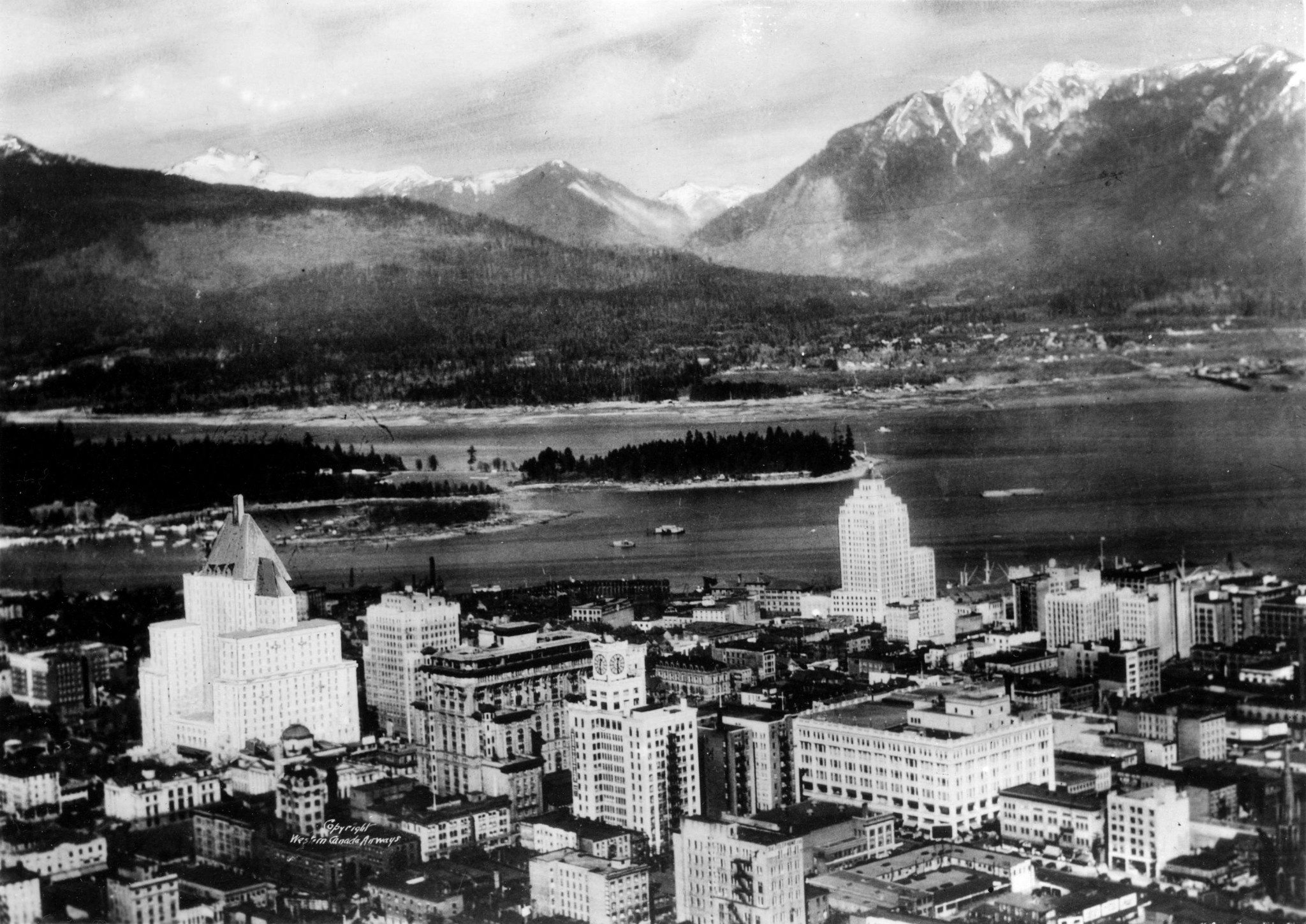
Image: City of Vancouver Archives
1947: Soaring over Metro Vancouver

Image: City of Vancouver Archives
1948: Downtown is a tiny spec behind the vast South Vancouver foreground
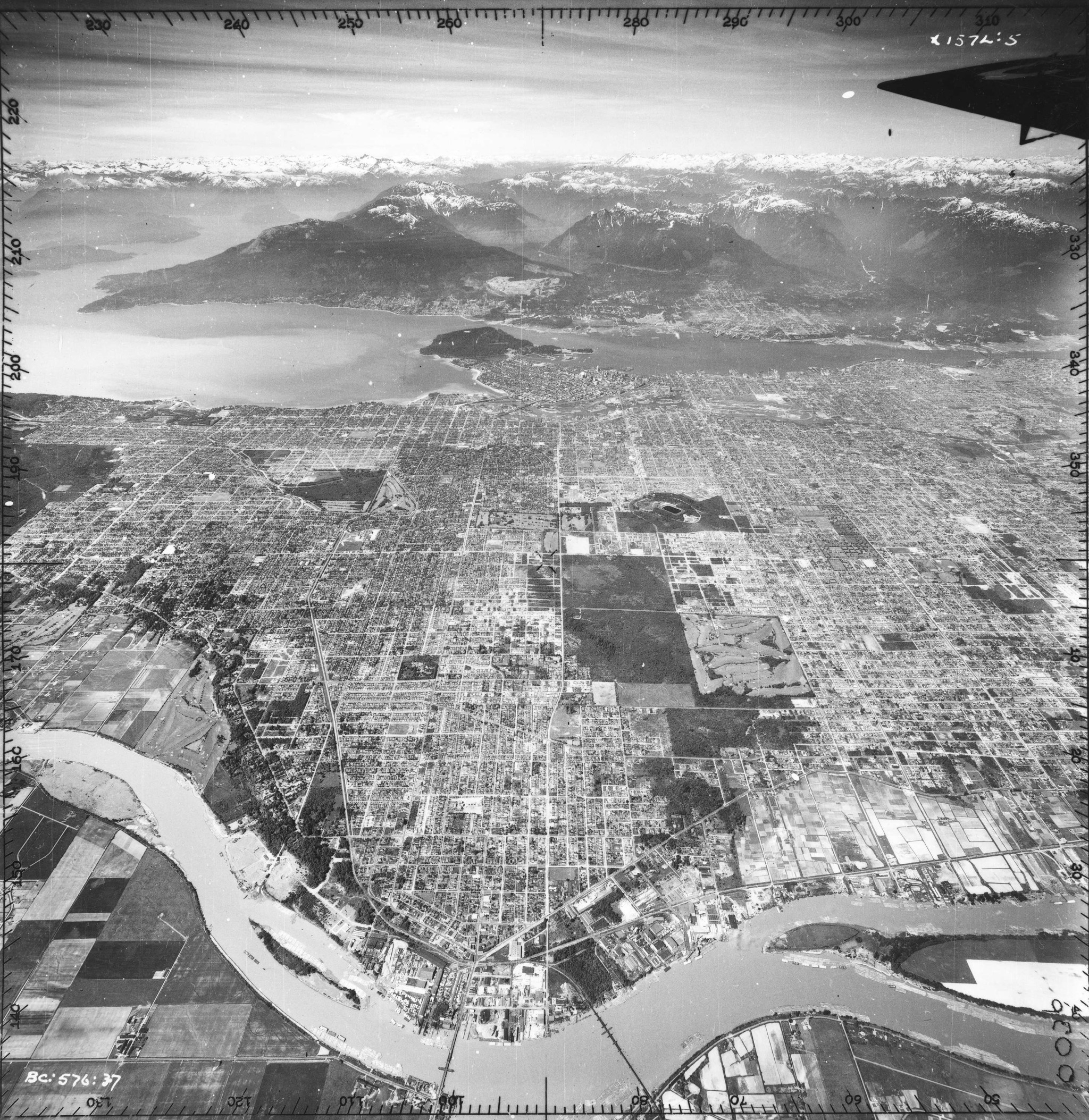
Image: City of Vancouver Archives
1948: Richmond is only farmland in this wide-view shot
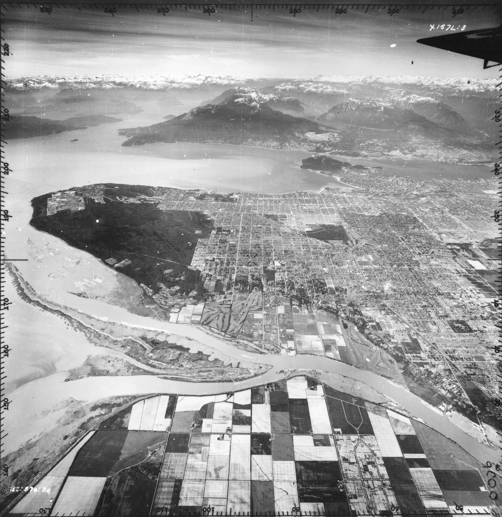
Image: City of Vancouver Archives
1962: The PNE Fairgrounds and Empire Stadium look much different now

Image: City of Vancouver Archives
1970s: Looking toward Downtown between the Burrard and Granville Bridges. Future home of Vancouver House

Image: City of Vancouver Archives
1970s: Yaletown is yet to be built up into glass towers in this shot showing the industrialization of False Creek
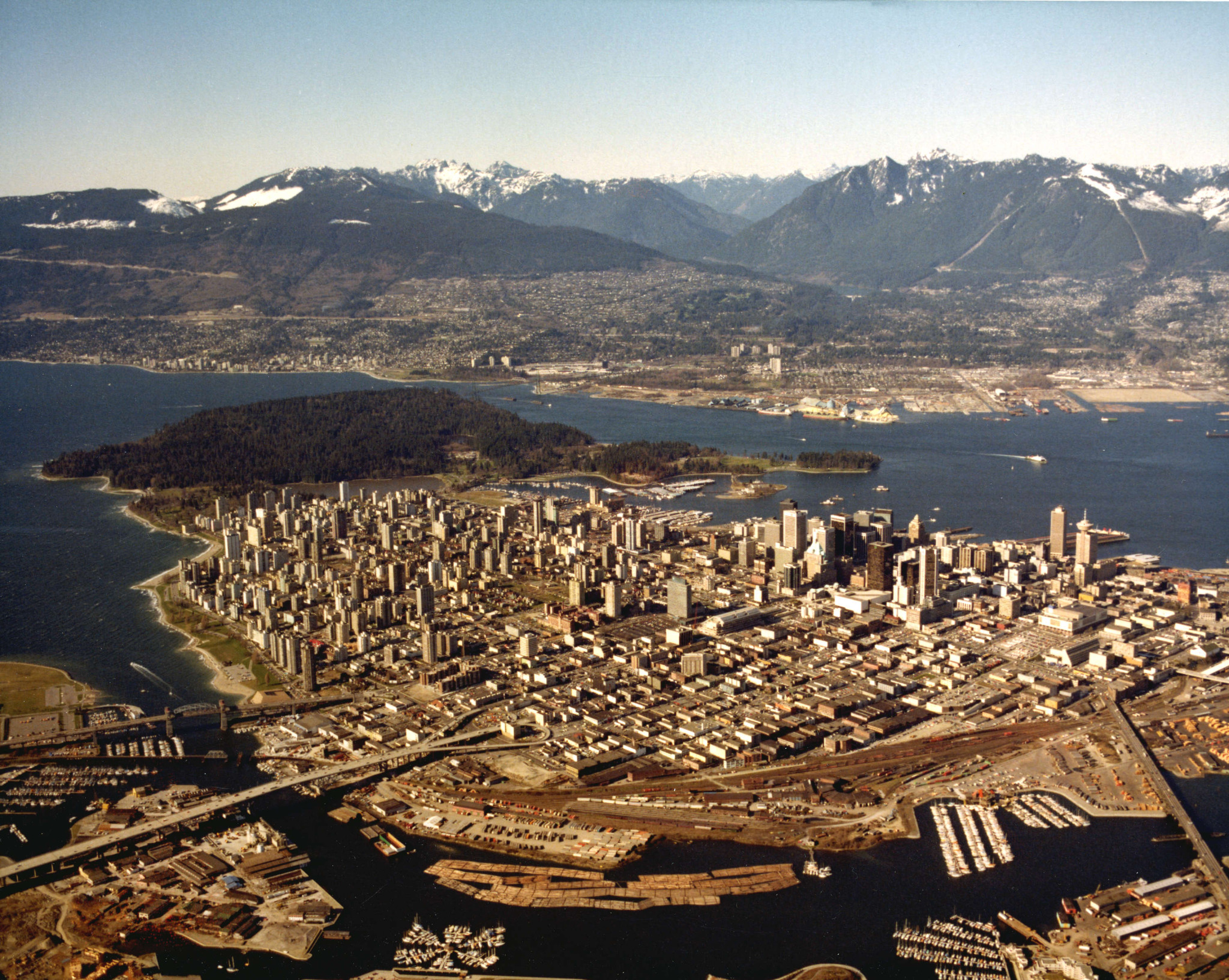
Image: City of Vancouver Archives
1970s: Looking over the end of False Creek. Now the home of Science World
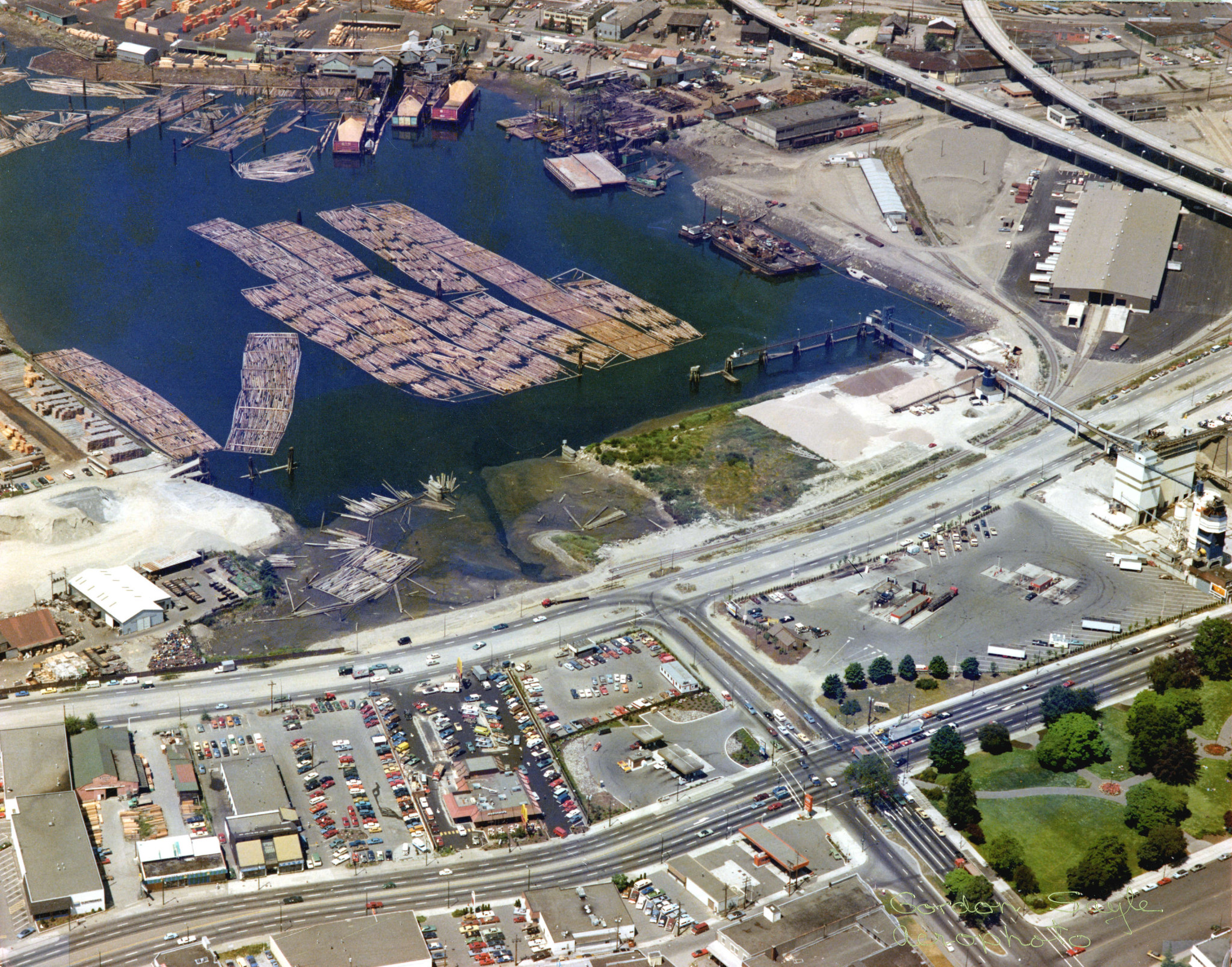
Image: City of Vancouver Archives
1972-1981: The highway that never was: the roadway connected East Van to Downtown and all that remains are the Georgia Viaducts… for now
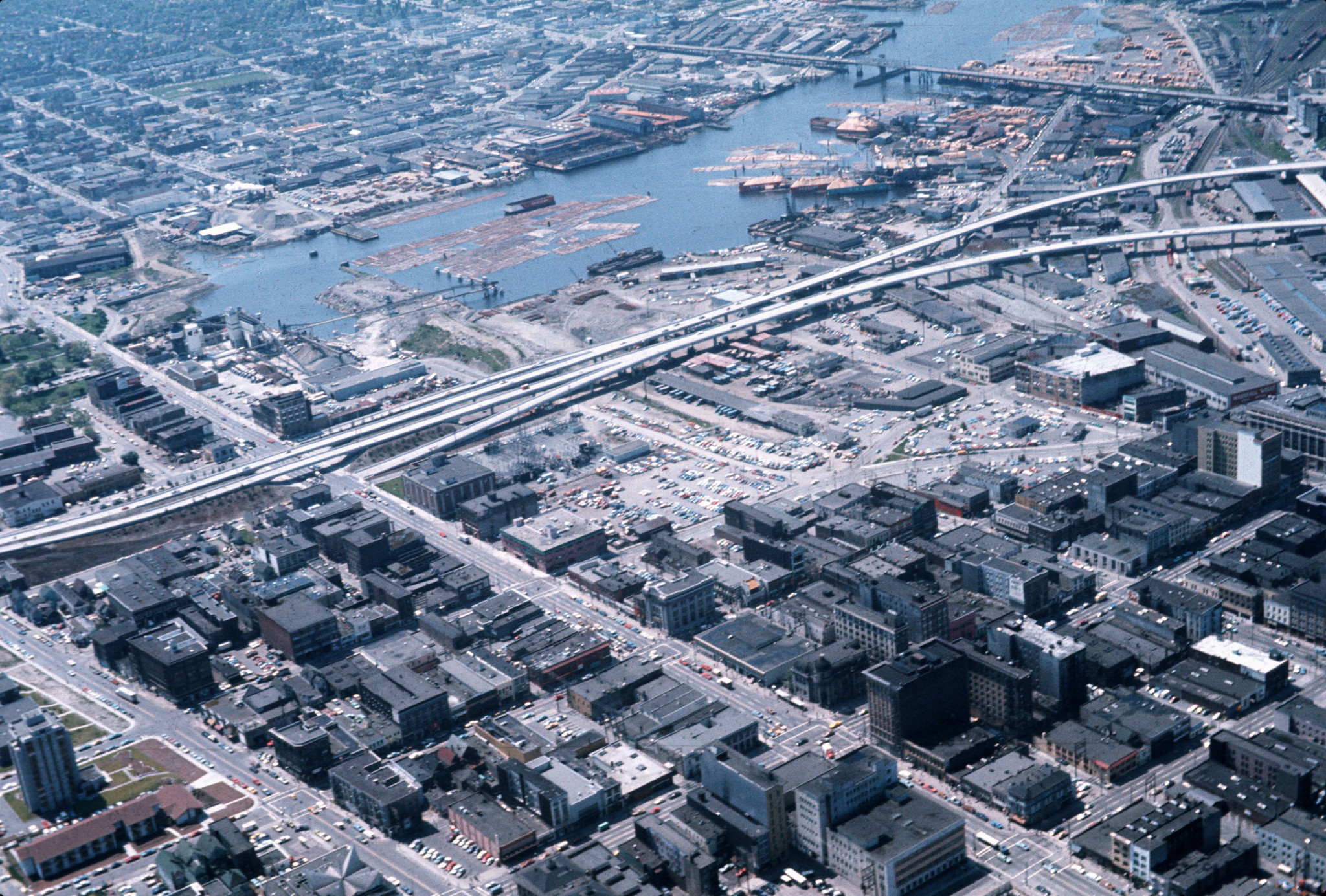
Image: City of Vancouver Archives
1974-1977: Sunrise over False Creek. Note the Scotiabank Tower being constructed Downtown

Image: City of Vancouver Archives
1980s: The newly-constructed BC Place draws all the attention in this aerial shot

Image: City of Vancouver Archives
1988: The North Shore expands while Downtown grows taller in Vancouver’s post-Expo boom

Image: Skyscraper Page
1999: Yaletown has begun its rapid ascension into the sky with the first few towers taking over the False Creek waterfront

Image: Sonja Pederson Real Estate
2010: BC Place’s iconic dome roof is removed before a brand-new design is constructed, just after the 2010 Winter Olympics

Image: Cliff Hellis via Flickr
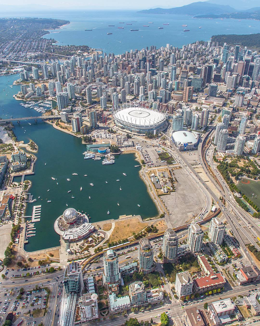
2015: A beautiful summer day showcases just how stunning Vancouver is. In another five years, the skyline will be completely different with the removal of the viaducts and the construction of new towers in the False Creek flats
[am2_see_also]
[am2_see_also]