


We may be lucky enough to live in beautiful British Columbia, but how many of us ever get out and enjoy the great outdoors beyond Whistler?
Well, pack your bags, strap on your hiking boots and let’s get out there!
From black sands flecked with gold to volcanic mountains tinged with lavender, there are some huge hikes just waiting for you in the wilderness.
Here’s a rundown of six of the most gobsmacking hikes to tempt you out on the open road…starting with one closer to home.
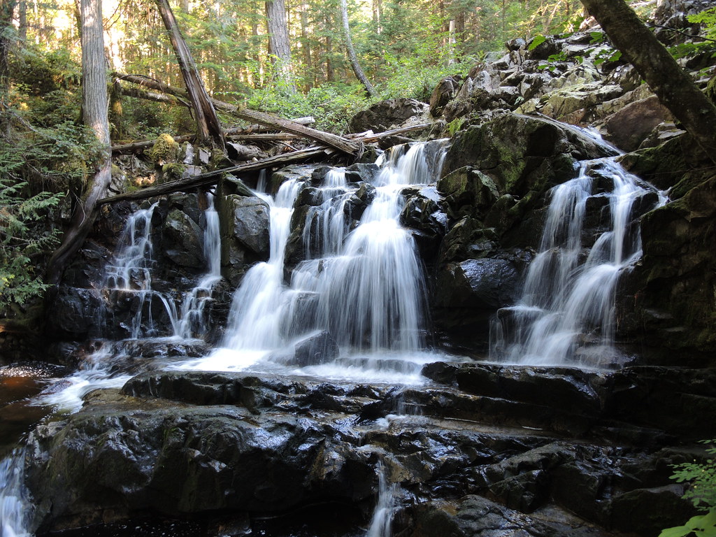
West Coast Trail – Vancouver Island

A view from the West Coast Trail on Vancouver Island (Su-Laine Yeo Brodsky/Flickr)
What: A rugged, but breathtaking hike through the lands of the Ditidaht First Nation in Pacific Rim National Park, that’s open between May 1 – September 30. Sure, you’ll be wading through rivers, negotiating steep slopes, climbing ladders and using cable cars, but it will all be worth it, as you take in lush rainforests, isolated beaches, beautiful waterfalls and stunning views of the Pacific Ocean. Watch out for cougars, black bears, wolves – and whales.
How long: Up to 7 days or 75 km
Where: The trail runs between Pachena Bay, near Bamfield, and Gordon Point, near Port Renfrew, and there is a midway entry/exit point at Nitinat Lake.
Get there: At least a three-hour drive from Nanaimo, once you’ve taken the ferry across to the island. Note that some of the trailheads are accessed via logging roads so you should have a reliable vehicle with a spare tire. Or take the shuttle bus service from Victoria or Nanaimo.
[am2_see_also]
East Beach Trail – Haida Gwaii

Pesuta shipwreck on the East Beach Trail in Haida Gwaii (Karen Neoh/Flickr)
What: An isolated, strenuous hike along the sandy coastline of Naikoon Provincial Park in Haida Gwaii – you’ll need navigational skills and backcountry experience. But if you want to get away from it all, this is the place – you’re unlikely to see anyone else on the entire trail. Along the way, as you wade through rivers and march through sand dunes, you’ll find a 1920s shipwreck, eroding cliffs, black sand rumoured to contained flecks of gold – and even feral cattle.
How long: 3-5 days or 70-90 km
Where: Starts at Tlell and ends at Tow Hill on Graham Island.
Get there: A 30-hour drive – including a nine-hour ferry ride – from Vancouver. Or a two-hour flight from YVR to Sandspit followed by a one-and-a-half hour drive, including a 30-minute ferry ride.
Sunshine Coast Trail – Powell River
What: The longest hut-to-hut hiking experience in Canada – and the only free one. This long but relatively moderate hike begins at the ocean and takes you through alpine meadows and old growth forests to panoramic mountaintops, rushing waterfalls and breathtaking back country. Look out for bears, eagles, dolphins and sea lions – to name just a few!
How long: Two weeks or 180 km
Where: Starts at Sarah Point in Desolation Sound, ends at Saltery Bay
Get there: A five-and-a-half hour drive from Vancouver, including two ferry rides, one for an hour and 20 minutes, the other for an hour. [am2_see_also]
Rainbow Range Trail – Chilcotin
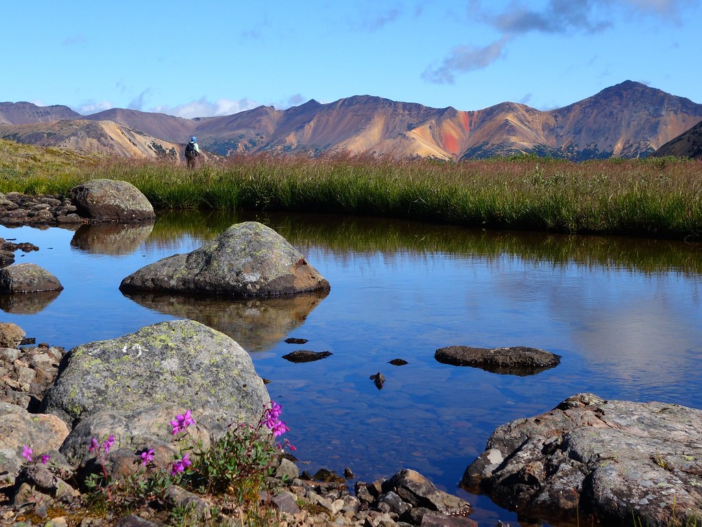 What: This moderate, round-trip trail in Tweedsmuir Provincial Park may be short but it’s truly gobsmacking, offering stunning views of deep blue alpine lakes and the red, yellow, orange and lavender-tinged volcanic Rainbow Mountains. You’ll likely not see another soul around, so you need to be self sufficient – and beware, there’s black bears and grizzlies out there. How long: 4-6 hours or 14 km – or camp out and keep hiking for days along the park’s myriad of connected trails. Where: Starts and ends Highway 20, near Tweedsmuir Provincial Park’s east entrance and Heckman Pass. Get there: A 12-hour drive from Vancouver, or one-hour flight to Bella Coola then an hour-and-a-half drive.
Rockwall Trail – Kootenay
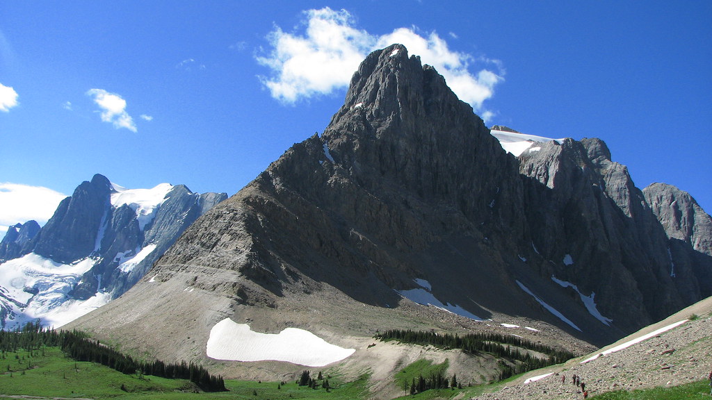 What: This majestic alpine hike over three different mountain passes in the Canadian Rockies is widely thought to be one of the best multi-day hikes anywhere in the world. Limestones cliffs will tower above you, carpets of wildflowers will surround you, as you marvel at hanging glaciers and thundering waterfalls.
How long: 3-5 days or 55 km
Where: Starts at the Floe Lake Trailhead and ends at the Paint Pots Trailhead, both off Highway 93 near Radium.
Get there: A 10-hour drive from Vancouver.
[am2_see_also]
Berg Lake Trail – Mount Robson
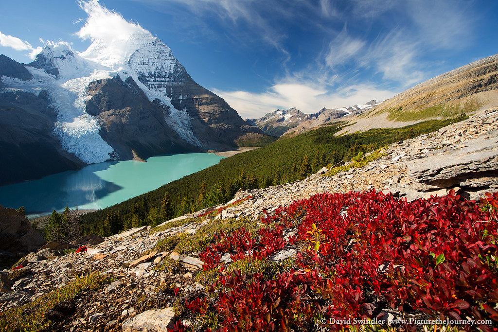
What: This moderate hike is dominated by mighty Mount Robson, the highest peak in the Canadian Rockies, and the surrounding valley, home to the world’s biggest inland rainforest. As you hike through the Valley of a Thousand Falls, to beautiful, glacial Berg Lake, take an amazing, alpine deep breath – and keep an eye open for moose, elk and, of course, bears.
How long: Two days or 44 km – or camp and keep enjoying the scenery along the many trails in the area. If you’re up for a challenge, you could also climb Mount Robson.
Where: Starts and ends at Mount Robson parking lot.
Get there: An eight-hour drive from Vancouver.