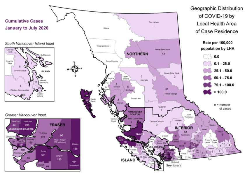
New map shows where coronavirus cases are specifically found in BC

The BC government has unveiled new coronavirus data in the form of a map, meant to give the public more information as to where cases have specifically been discovered in the province.
“Early on, we reported by health authority only, because of the risk of identification of an individual due to the small number of cases,” Provincial Health Officer Dr. Bonnie Henry explained during a press conference this week.
- See also:
Now, however, “as we have had more cases here in BC, we’ve been able to provide data to communities and the public by what we call health service delivery areas — a smaller geographic area, and we are now at the point where we have sufficient data that we can go more granular than that – and this is what we call the local health area map of cases, and this map will be updated on a periodic basis.”
The map, she said, “tells us that virtually every part of our province has been touched by COVID-19.”

Government of BC
Henry said the online map will be updated monthly.

