
Up to 8 cm of snow could fall in Metro Vancouver by Friday

Winter conditions could return to Metro Vancouver beginning Thursday night when a low pressure system carrying some moisture makes landfall and collides with cold air.
Environment Canada’s latest forecast this morning anticipates between 4 cm and 8 cm of snow from Thursday night through Friday for Vancouver’s main weather station at Vancouver International Airport. Temperatures will dip to an overnight low of -2°C.
As usual, areas in the city, further east, and on higher terrain – away from the warming influence of sea water – could see greater accumulations.
At times, the snow may be mixed with wet snow or rain.
There is a continued chance of snow over the weekend, which could potentially go on next week with precipitation falling during temperatures at or near the freezing point.
Any accumulation on the ground is unlikely to last long unlike this winter’s previous snowfall periods. This winter to date, the weather station at YVR has already recorded 50 cm of snow.
Some areas in the region, particularly over higher terrain, have already seen new snow. The Simon Fraser University campus atop Burnaby Mountain received a dusting yesterday.
@SFU right now! This is crazy 😱 #burnaby #snow pic.twitter.com/YDWmwHXjXS
— Alicia Pavan (@AliciaVPP) February 22, 2017
@SFU winter is coming are classes being canceled to prepare for Jon Snow? pic.twitter.com/1Vzib1vMB0
— Jacob Webb (@Jacobwebb101) February 22, 2017
Vancouver International Airport
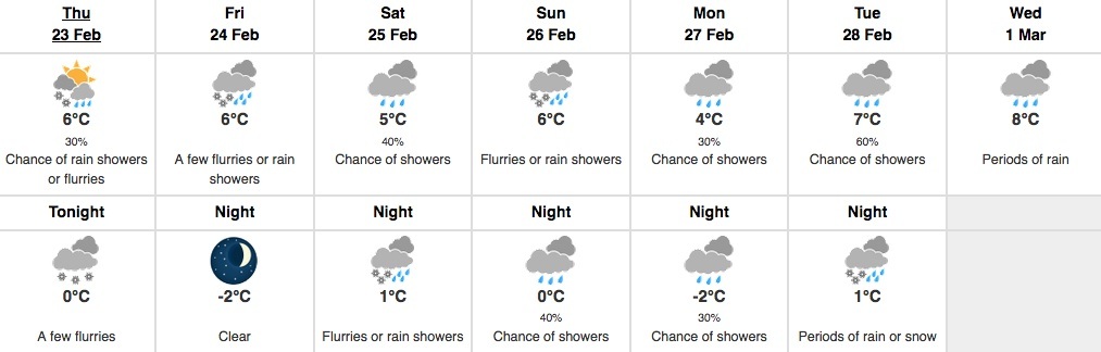
Image by: Environment Canada
Abbotsford International Airport
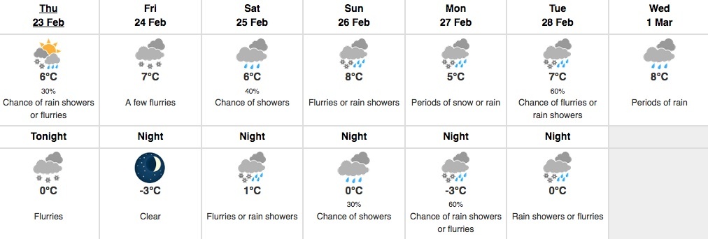
Image by: Environment Canada
Squamish
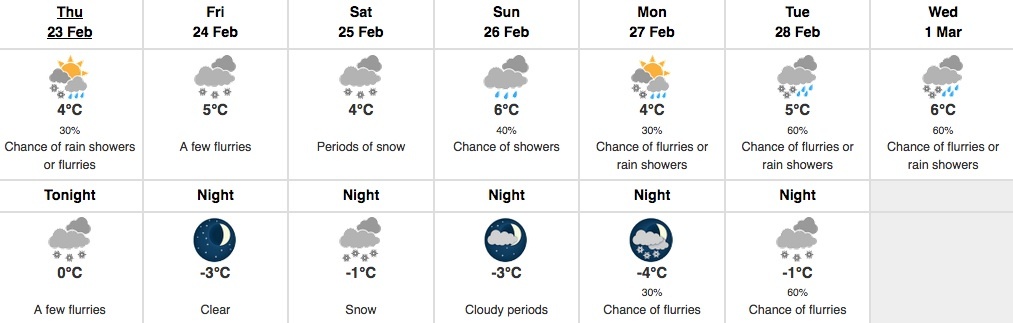
Image by: Environment Canada
Whistler Village

Image by: Environment Canada

Follow Channels and Categories